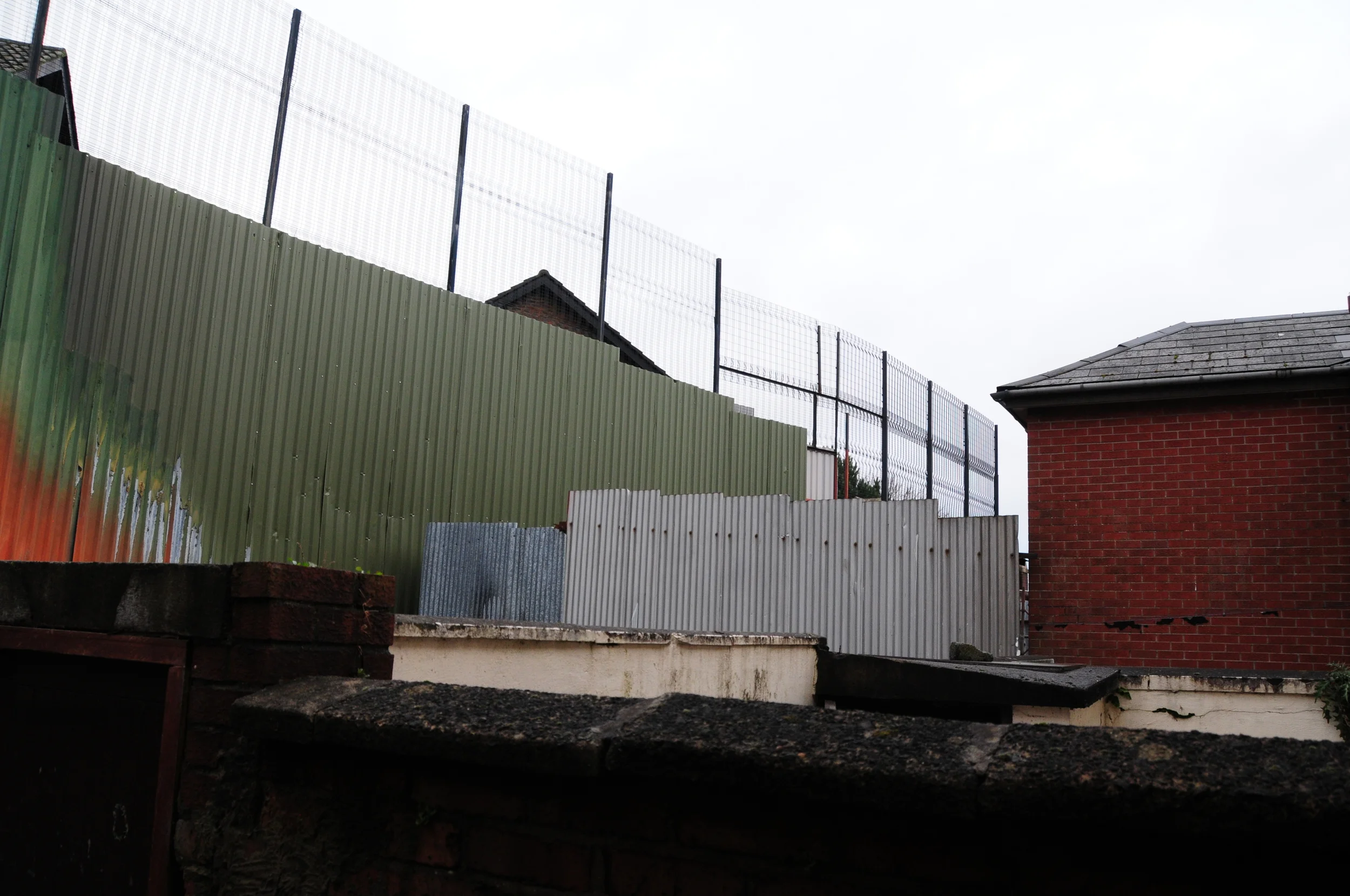
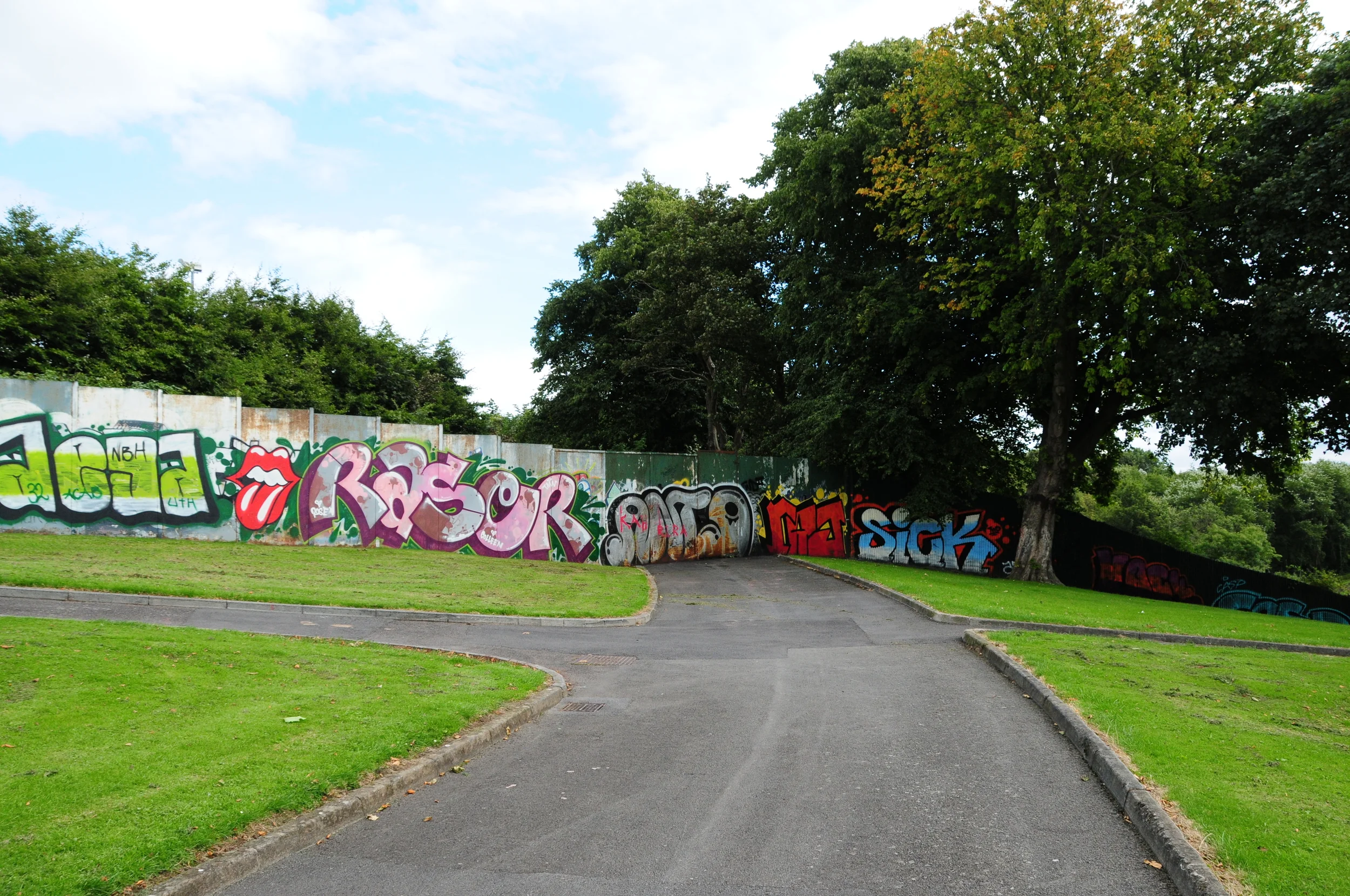
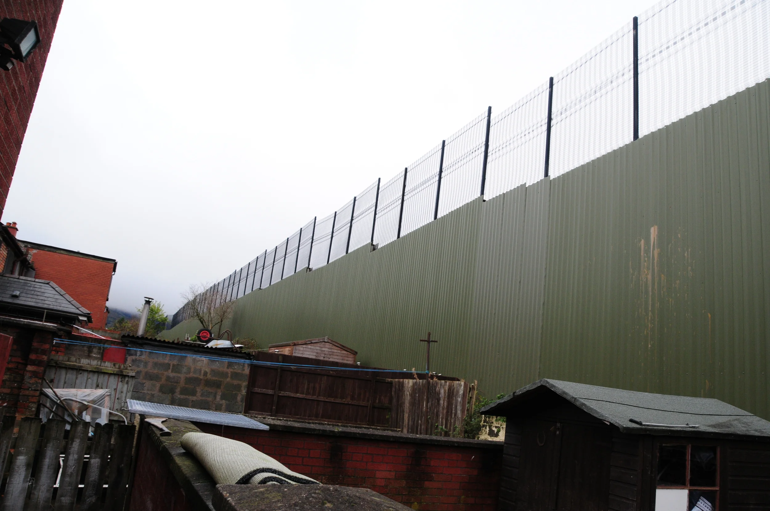
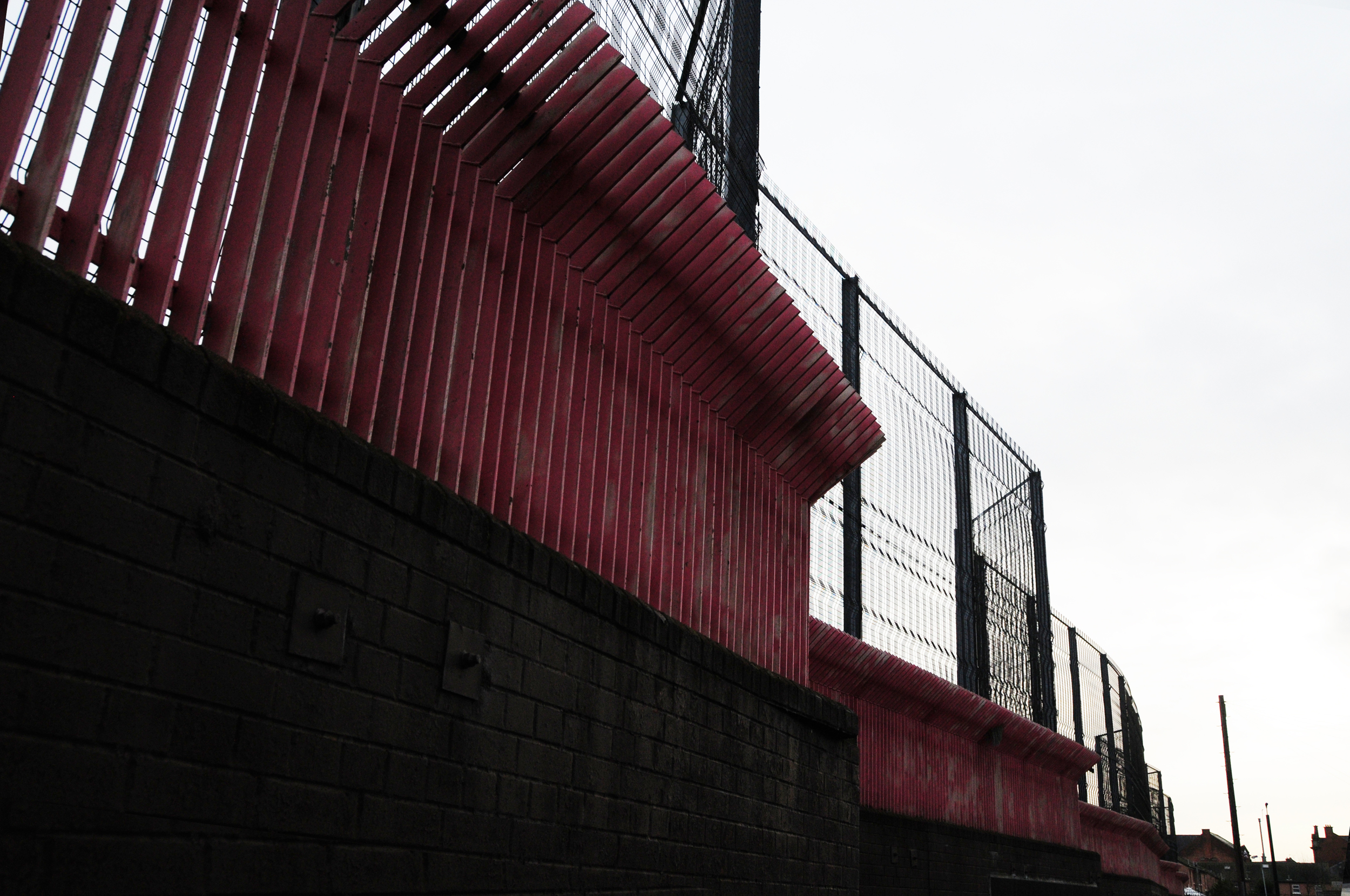
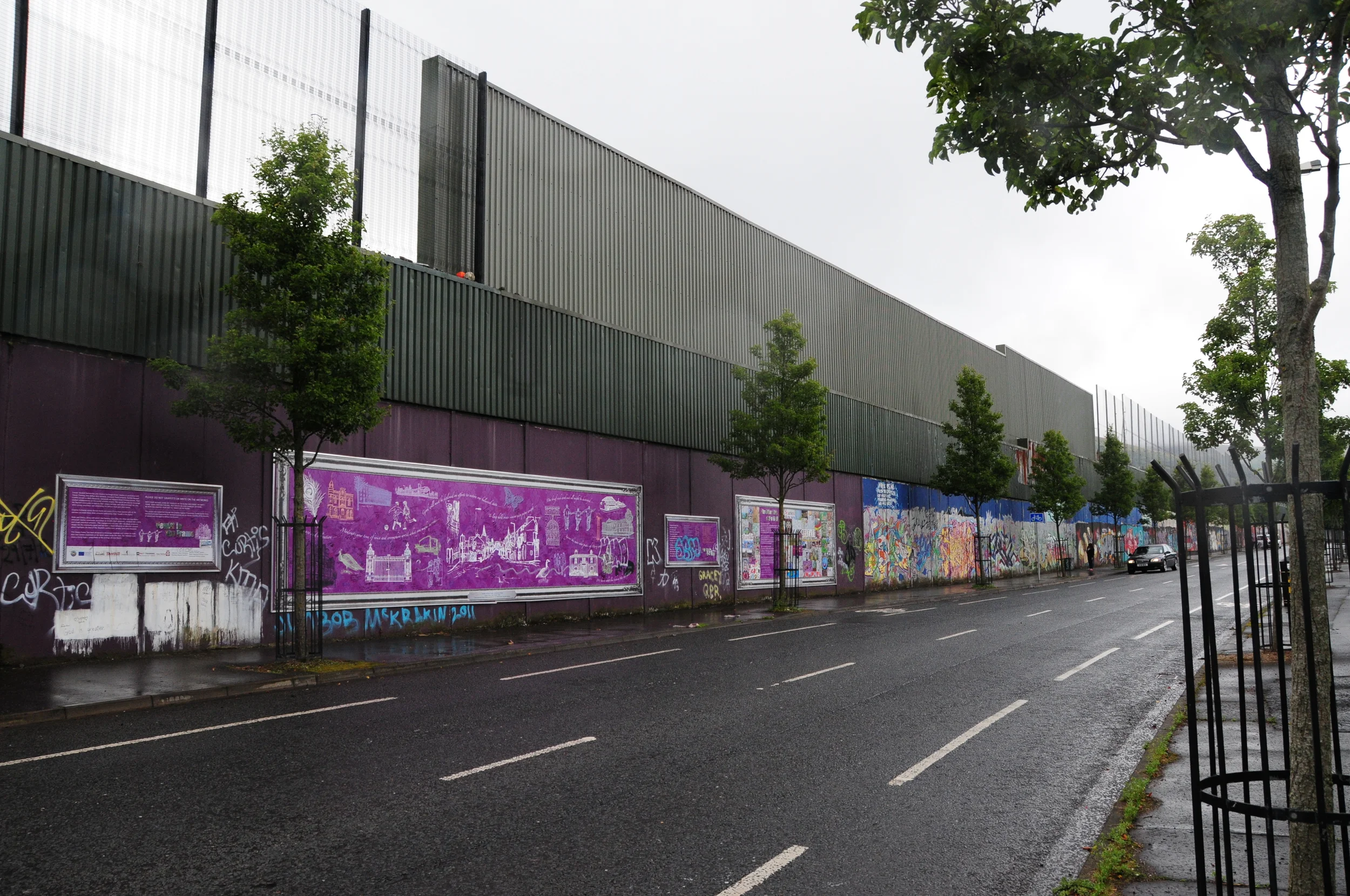
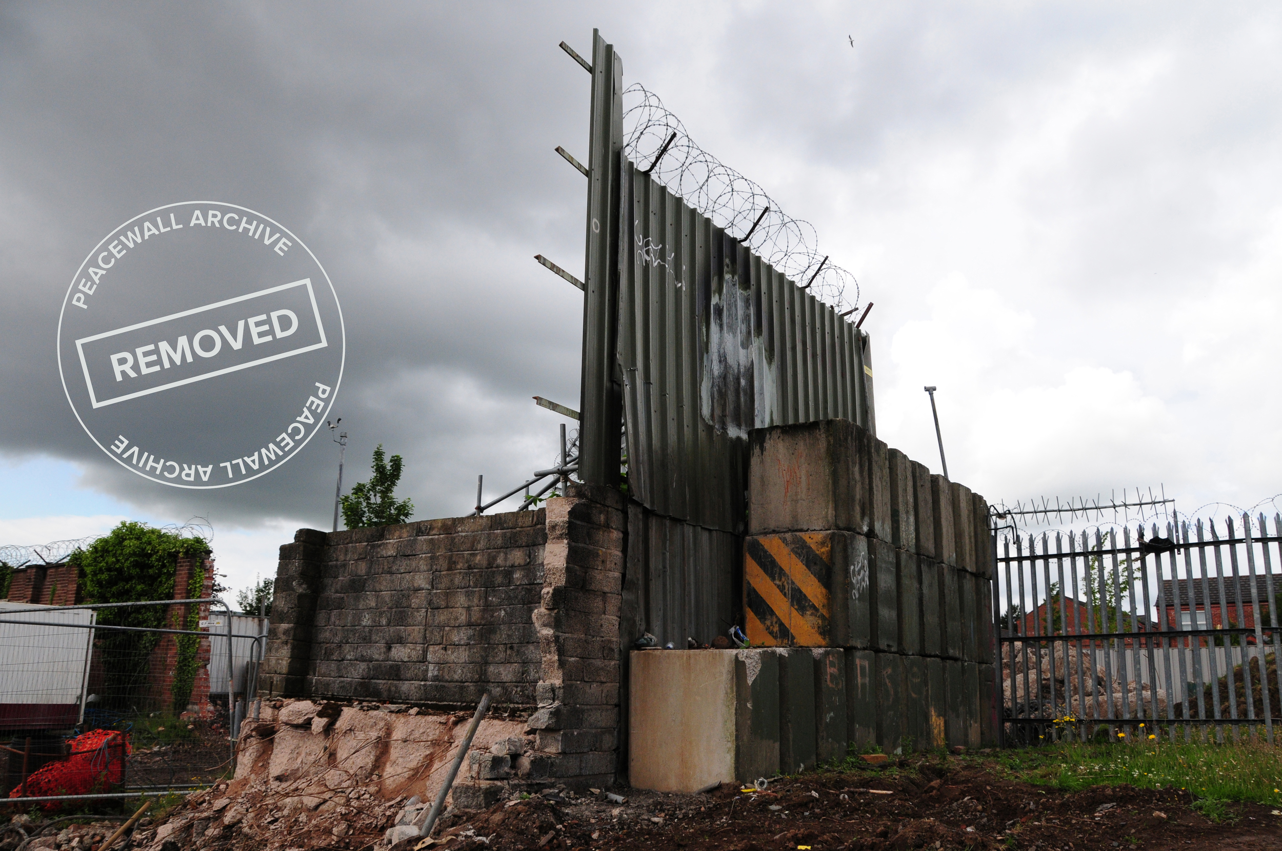
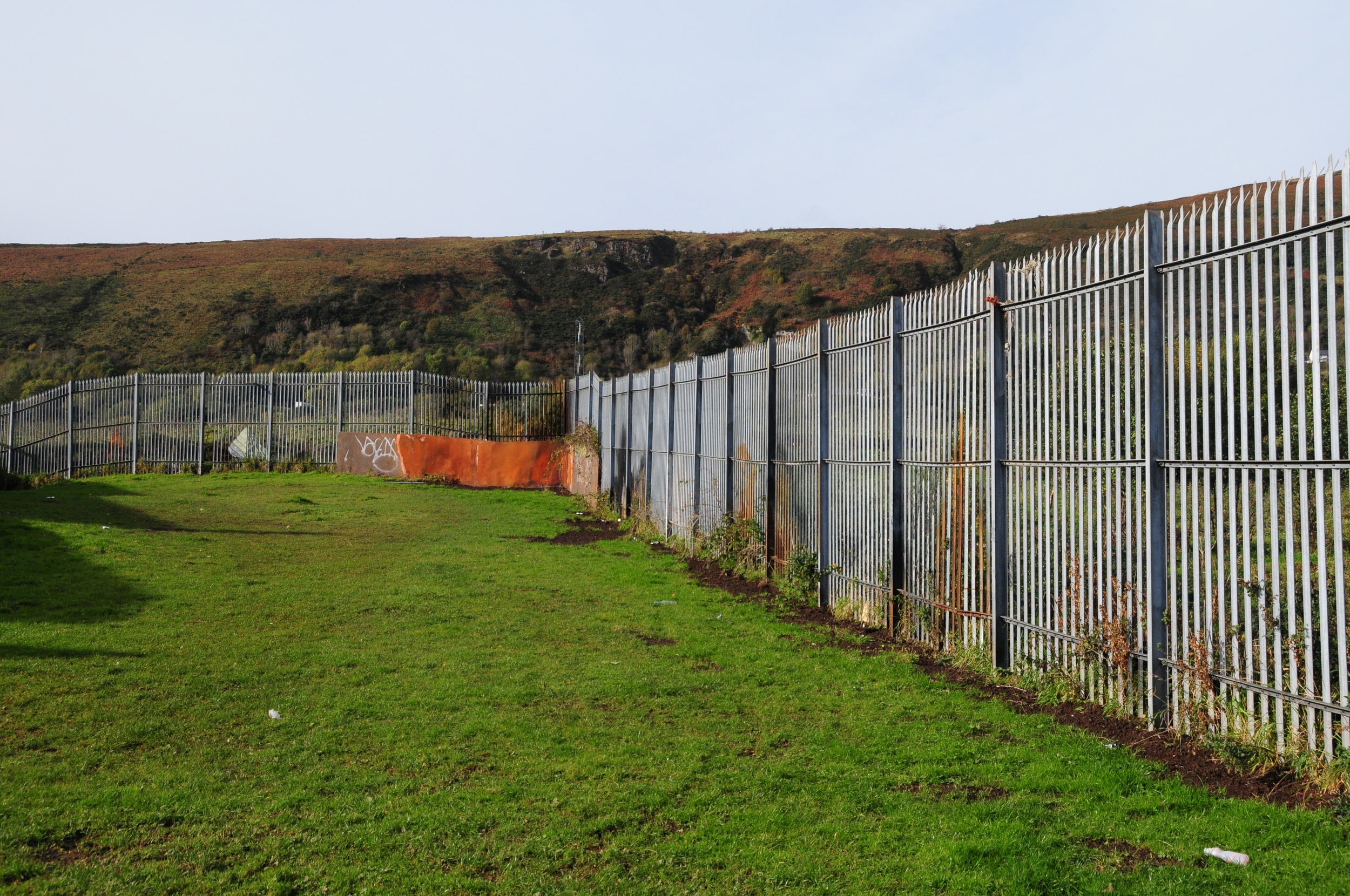
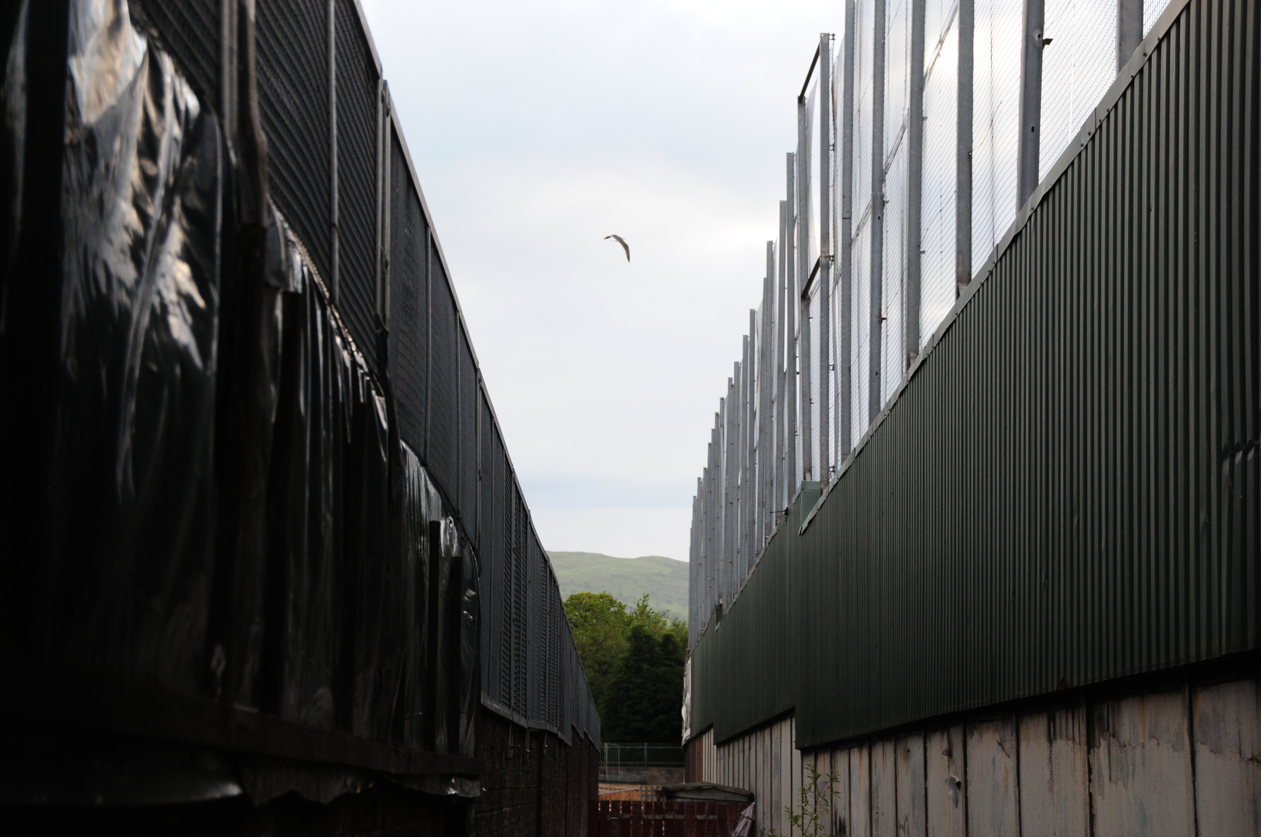
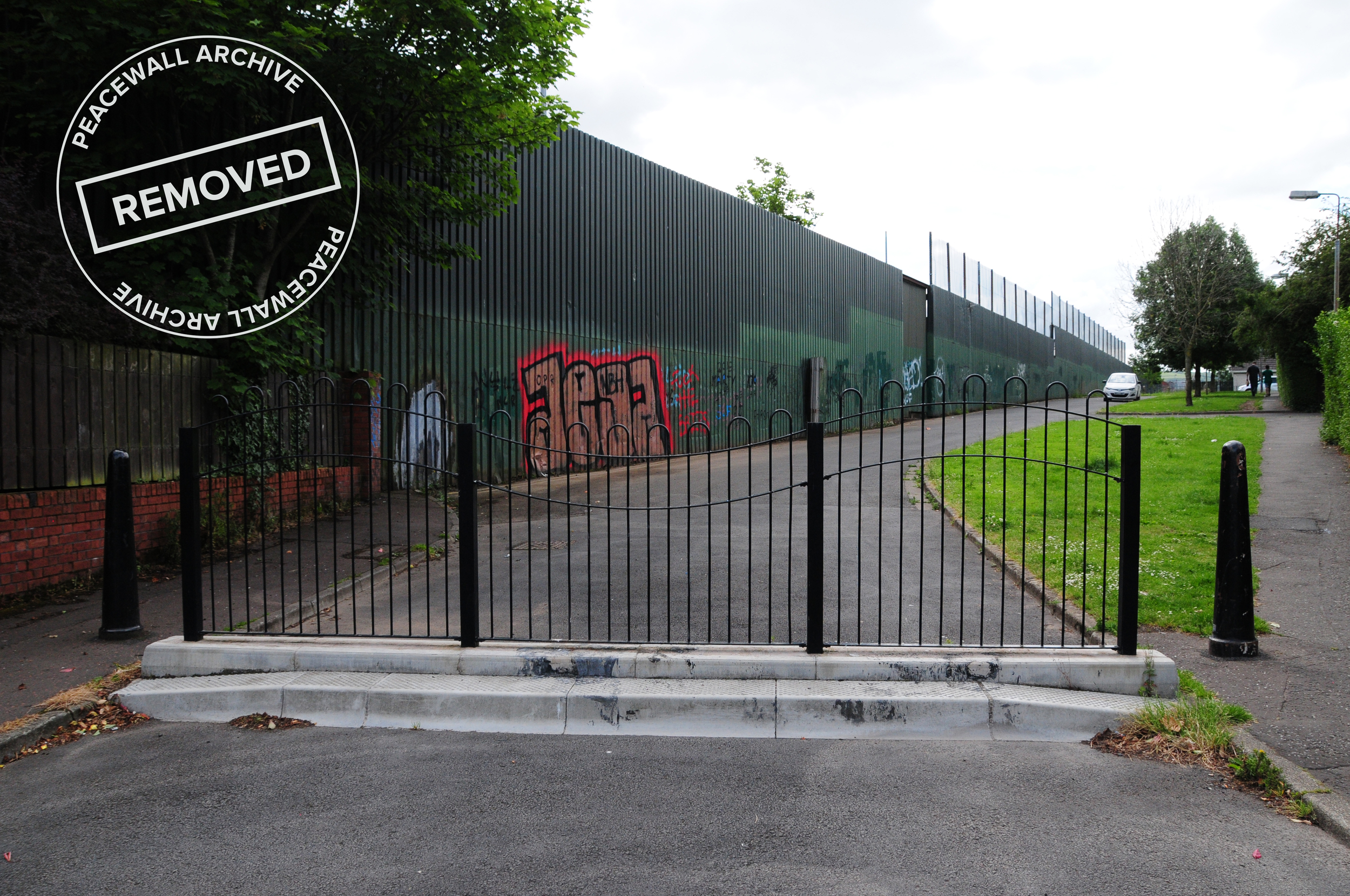
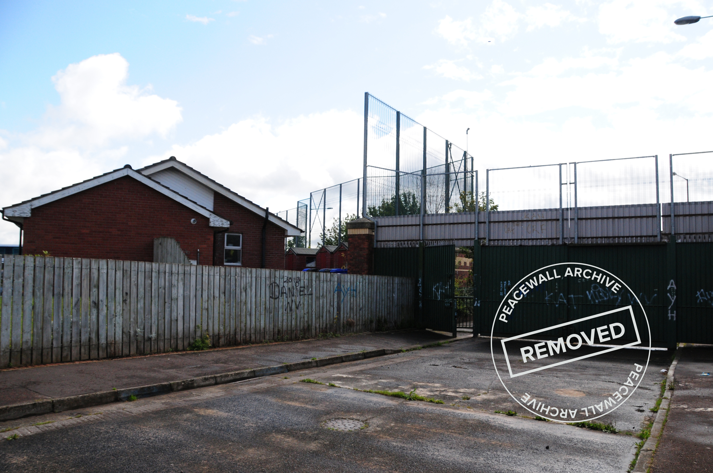
Alliance Avenue
3.1.1 Reference code(s)
UK INT-ARC PA2015 CL09-P0001
3.1.2 Title
Photograph of Interface Barrier at Alliance Avenue from Ardoyne side
3.1.3 Cluster
BIP Interface Cluster 09: Ardoyne-Glenbryn
3.1.4 Owner
NI Department of Justice
3.1.5 Year built:
1991 & 2003
3.1.6 Type
A steel and sheet metal barrier, up to 9 metres high.
3.2.1 Date of description
2014
3.2.2 Level of description
Items
3.2.3 Extent and Medium
Digital Image - 4288 × 2848 NIKON D300 Colour
3.2.4 Name of creator(s)
© James O'Leary
3.2.5 Archival History
Archived on June 5, 2015
3.4.1 Conditions of access
No restrictions on access. Reproduction requires permission.
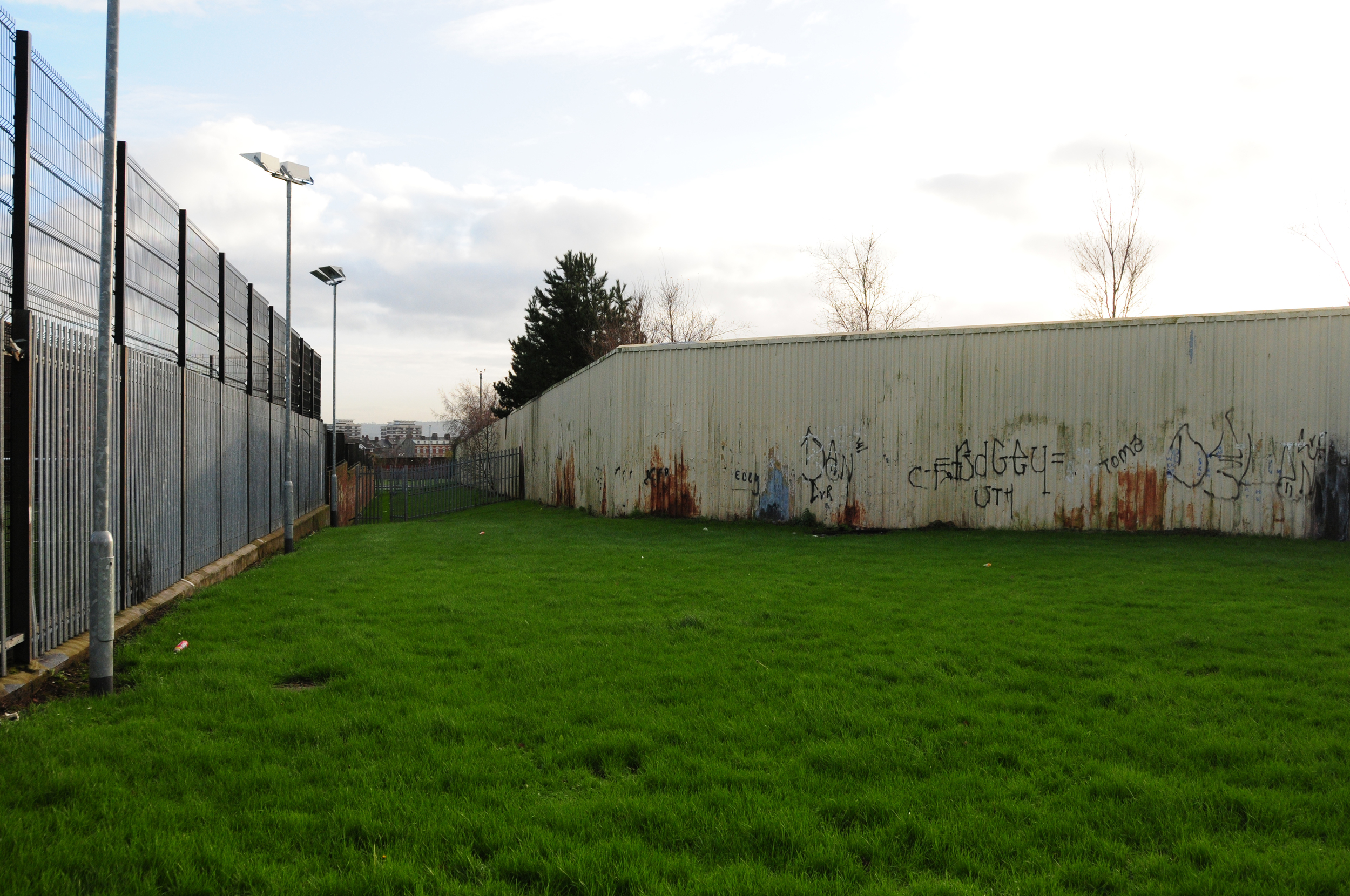
Glenbryn Park
3.1.1 Reference code(s)
UK INT-ARC PA2015 CL09-P0002
3.1.2 Title
Photograph of Interface Barrier at Glenbryn Park from Glenbryn side
3.1.3 Cluster
BIP Interface Cluster 09: Ardoyne-Glenbryn
3.1.4 Owner
NI Department of Justice
3.1.5 Year built:
1991 & 2003
3.1.6 Type
A steel and sheet metal barrier, up to 9 metres high.
3.2.1 Date of description
2014
3.2.2 Level of description
Items
3.2.3 Extent and Medium
Digital Image - 4288 × 2848 NIKON D300 Colour
3.2.4 Name of creator(s)
© James O'Leary
3.2.5 Archival History
Archived on June 5, 2015
3.4.1 Conditions of access
No restrictions on access. Reproduction requires permission.
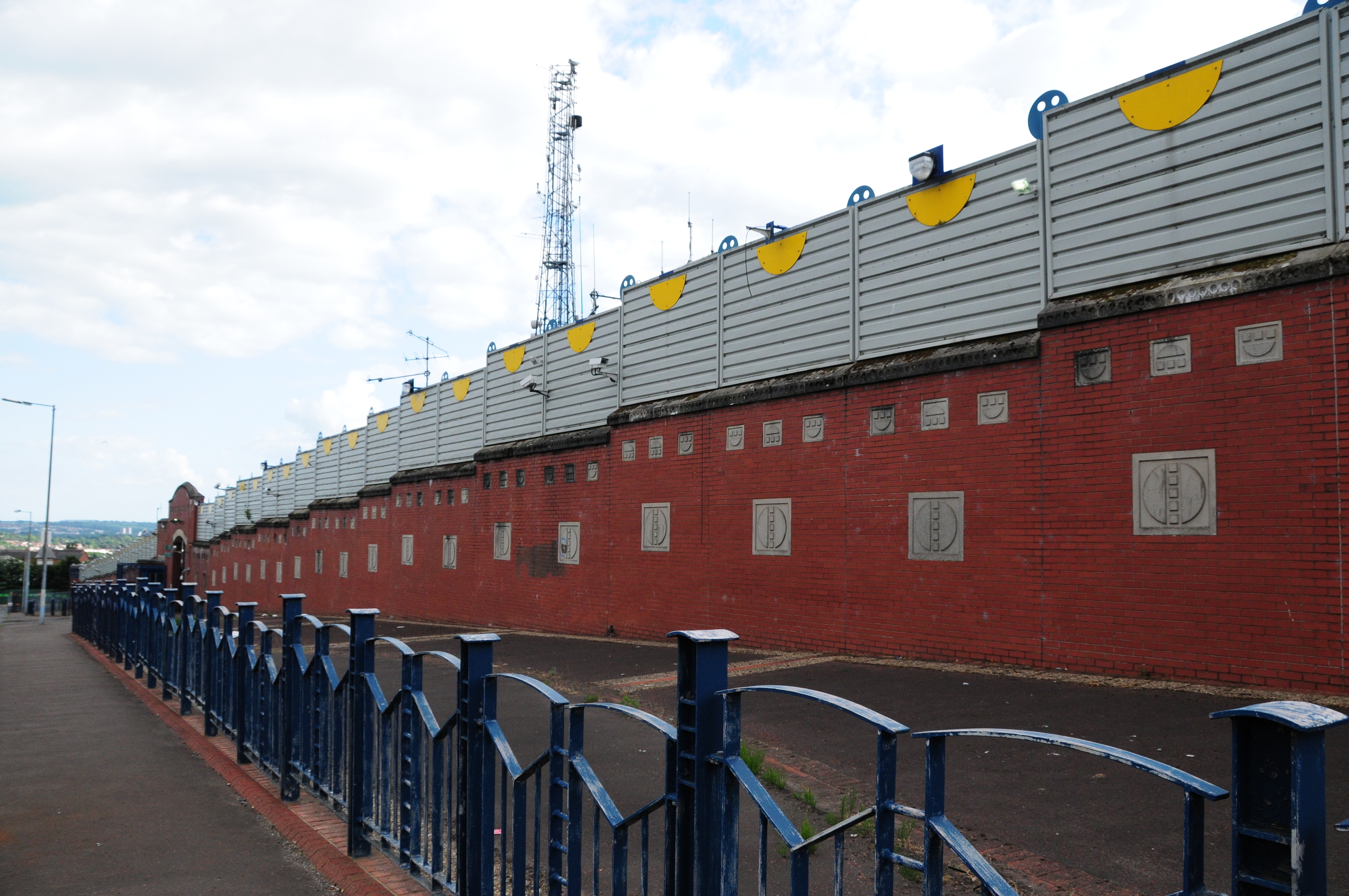
Brucevale Park
3.1.1 Reference code(s)
UK INT-ARC PA2015 CL08-P0003
3.1.2 Title
Photograph of Interface Barrier at Brucevale Park from east side looking north.
3.1.3 Cluster
BIP Interface Cluster 08: Lower Oldpark / Manor Street
3.1.4 Owner
NI Department for Social Development
3.1.5 Year built:
1978
3.1.6 Type
A steel and sheet metal barrier, topped with open mesh in places, up to 5 metres high.
3.2.1 Date of description
2014
3.2.2 Level of description
Items
3.2.3 Extent and Medium
Digital Image - 4288 × 2848 NIKON D300 Colour
3.2.4 Name of creator(s)
© James O'Leary
3.2.5 Archival History
Archived on June 5, 2015
3.4.1 Conditions of access
No restrictions on access. Reproduction requires permission.
Stanhope Street
3.1.1 Reference code(s)
UK INT-ARC PA2015 CL09-P0003
3.1.2 Title
Photograph of Interface Barrier at Stanhope Street Westlink from south side
3.1.3 Cluster
BIP Interface Cluster 05: Inner Ring
3.1.4 Owner
NI Department for Regional Development
3.1.5 Year built:
Unknown
3.1.6 Type
A steel and open mesh barrier, up to 6 metres high.
3.2.1 Date of description
2014
3.2.2 Level of description
Items
3.2.3 Extent and Medium
Digital Image - 4288 × 2848 NIKON D300 Colour
3.2.4 Name of creator(s)
© James O'Leary
3.2.5 Archival History
Archived on June 5, 2015
3.4.1 Conditions of access
No restrictions on access. Reproduction requires permission.
Alexandra Park
3.1.1 Reference code(s)
UK INT-ARC PA2015 CL09-P0004
3.1.2 Title
Photograph of Interface Barrier at Alexandra Park from west side
3.1.3 Cluster
BIP Interface Cluster 07: Limestone Road / Alexandra Park
3.1.4 Owner
NI Department of Justice
3.1.5 Year built:
1994 & 1990s
3.1.6 Type
A steel metal barrier, 120 metres long and 3.5 metres high.
3.2.1 Date of description
2014
3.2.2 Level of description
Items
3.2.3 Extent and Medium
Digital Image - 4288 × 2848 NIKON D300 Colour
3.2.4 Name of creator(s)
© James O'Leary
3.2.5 Archival History
Archived on June 5, 2015
3.4.1 Conditions of access
No restrictions on access. Reproduction requires permission.
Rosevale Street
3.1.1 Reference code(s)
UK INT-ARC PA2015 CL08-P0001
3.1.2 Title
Photograph of Interface Barrier at Rosevale Street from north side
3.1.3 Cluster
BIP Interface Cluster 08: Lower Oldpark / Manor Street
3.1.4 Owner
NI Department of Justice
3.1.5 Year built:
1980s
3.1.6 Type
A steel and metal sheet barrier, 200 metres long and 4 metres high.
3.2.1 Date of description
2014
3.2.2 Level of description
Items
3.2.3 Extent and Medium
Digital Image - 4288 × 2848 NIKON D300 Colour
3.2.4 Name of creator(s)
© James O'Leary
3.2.5 Archival History
Archived on June 5, 2015
3.4.1 Conditions of access
No restrictions on access. Reproduction requires permission.
St. Matthews Court
3.1.1 Reference code(s)
UK INT-ARC PA2015 CL12-P0001
3.1.2 Title
Photograph of Interface Barrier at St. Matthews Court from Newtownards Road looking west
3.1.3 Cluster
BIP Interface Cluster 12: Short Strand / Inner East
3.1.4 Owner
NI Department of Justice
3.1.5 Year built:
2013
3.1.6 Type
A retractable open mesh barrier on steel stanchions.
3.2.1 Date of description
2014
3.2.2 Level of description
Items
3.2.3 Extent and Medium
Digital Image - 4288 × 2848 NIKON D300 Colour
3.2.4 Name of creator(s)
© James O'Leary
3.2.5 Archival History
Archived on June 5, 2015
3.4.1 Conditions of access
No restrictions on access. Reproduction requires permission.
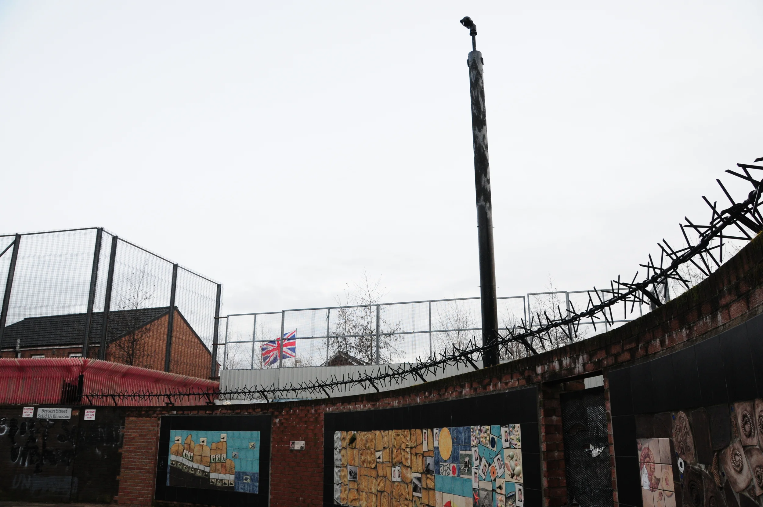
Bryson Street
3.1.1 Reference code(s)
UK INT-ARC PA2015 CL12-P0002
3.1.2 Title
Photograph of Interface Barrier at Bryson Street looking west
3.1.3 Cluster
BIP Interface Cluster 12: Short Strand / Inner East
3.1.4 Owner
NI Department of Justice (Maintained by NI Housing Executive)
3.1.5 Year built:
1970s & 2003
3.1.6 Type
A brick wall with mesh fencing above, to a total height of 7.5 metres, 275 metres long.
3.2.1 Date of description
2014
3.2.2 Level of description
Items
3.2.3 Extent and Medium
Digital Image - 4288 × 2848 NIKON D300 Colour
3.2.4 Name of creator(s)
© James O'Leary
3.2.5 Archival History
Archived on June 5, 2015
3.4.1 Conditions of access
No restrictions on access. Reproduction requires permission.
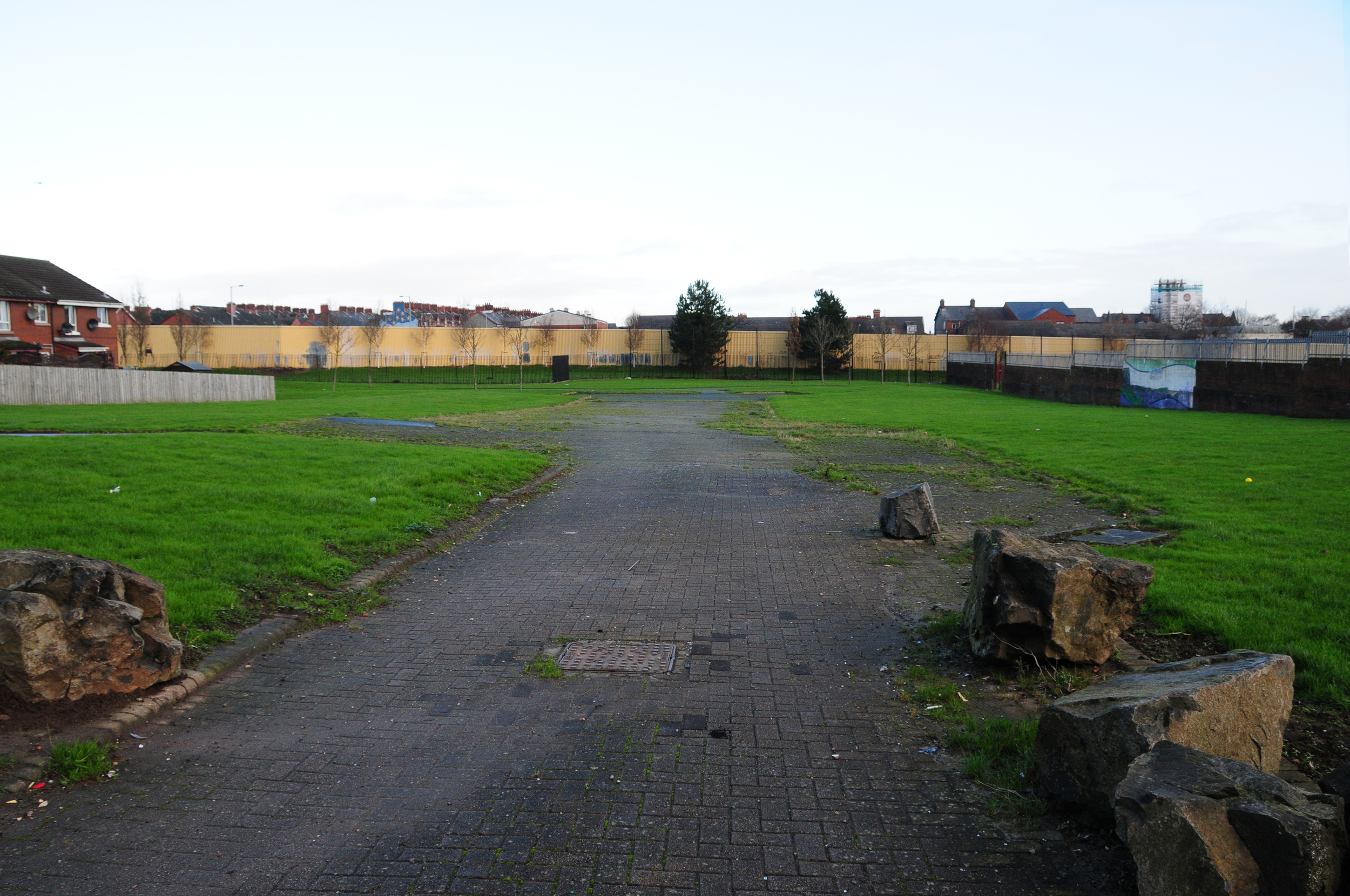
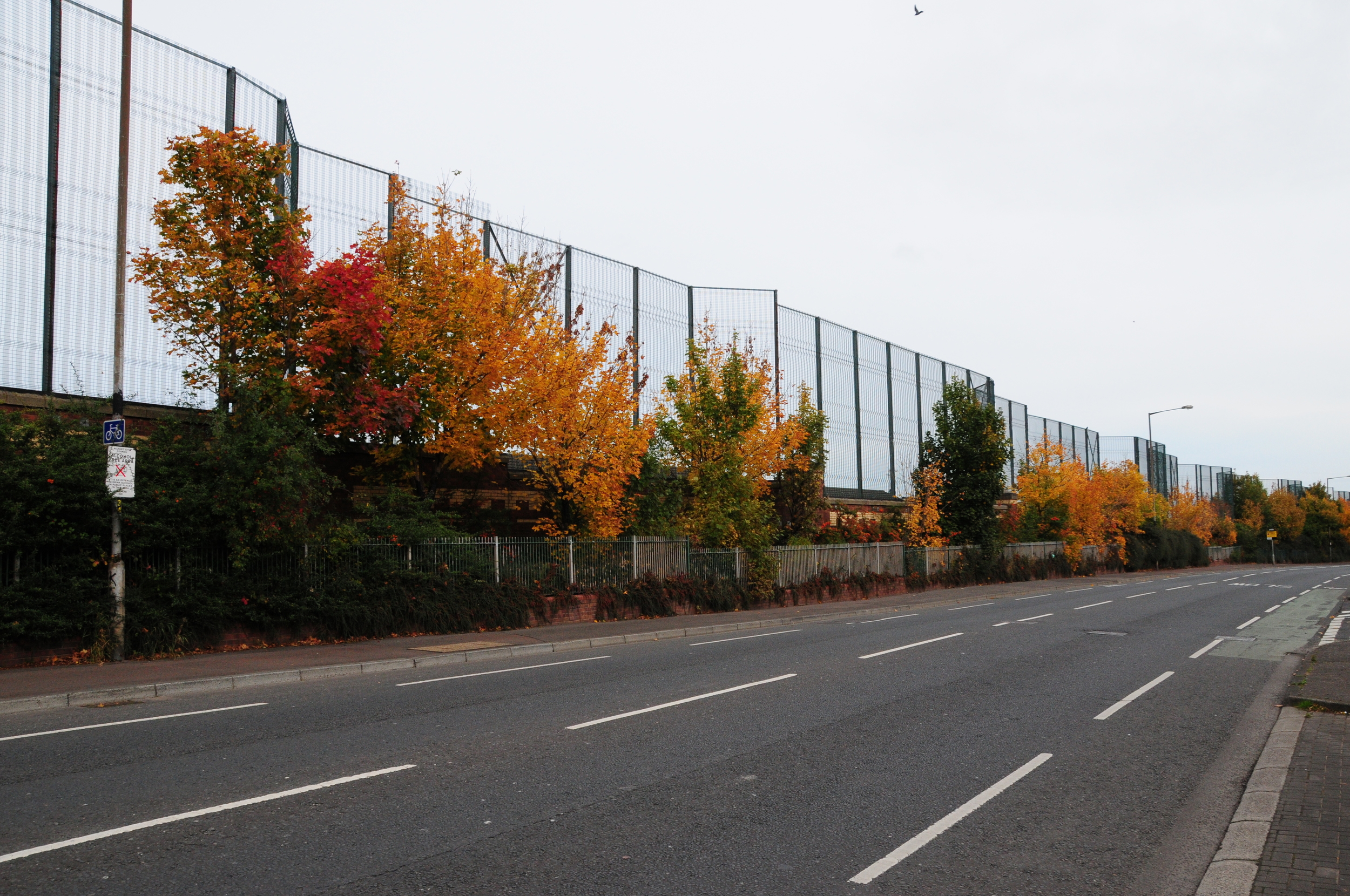
Alliance Avenue
3.1.1 Reference code(s)
UK INT-ARC PA2015 CL09-P0009
3.1.2 Title
Photograph of Interface Barrier at Alliance Avenue from Ardoyne side
3.1.3 Cluster
BIP Interface Cluster 09: Ardoyne-Glenbryn
3.1.4 Owner
NI Department of Justice
3.1.5 Year built:
1991 & 2003
3.1.6 Type
A steel and sheet metal barrier, up to 9 metres high.
3.2.1 Date of description
2014
3.2.2 Level of description
Items
3.2.3 Extent and Medium
Digital Image - 4288 × 2848 NIKON D300 Colour
3.2.4 Name of creator(s)
© James O'Leary
3.2.5 Archival History
Archived on June 5, 2015
3.4.1 Conditions of access
No restrictions on access. Reproduction requires permission.
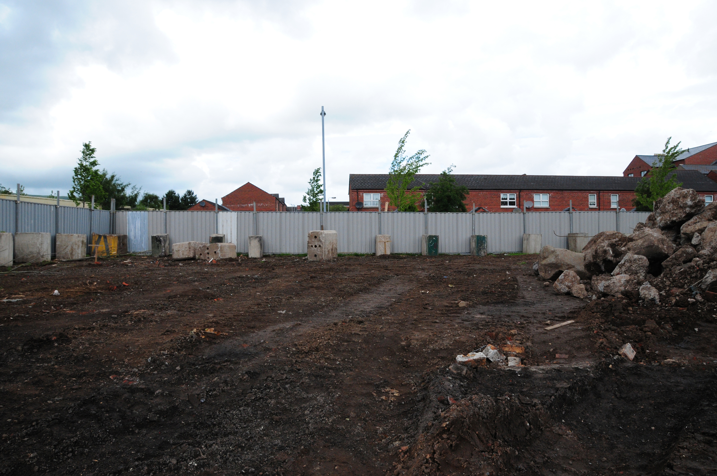
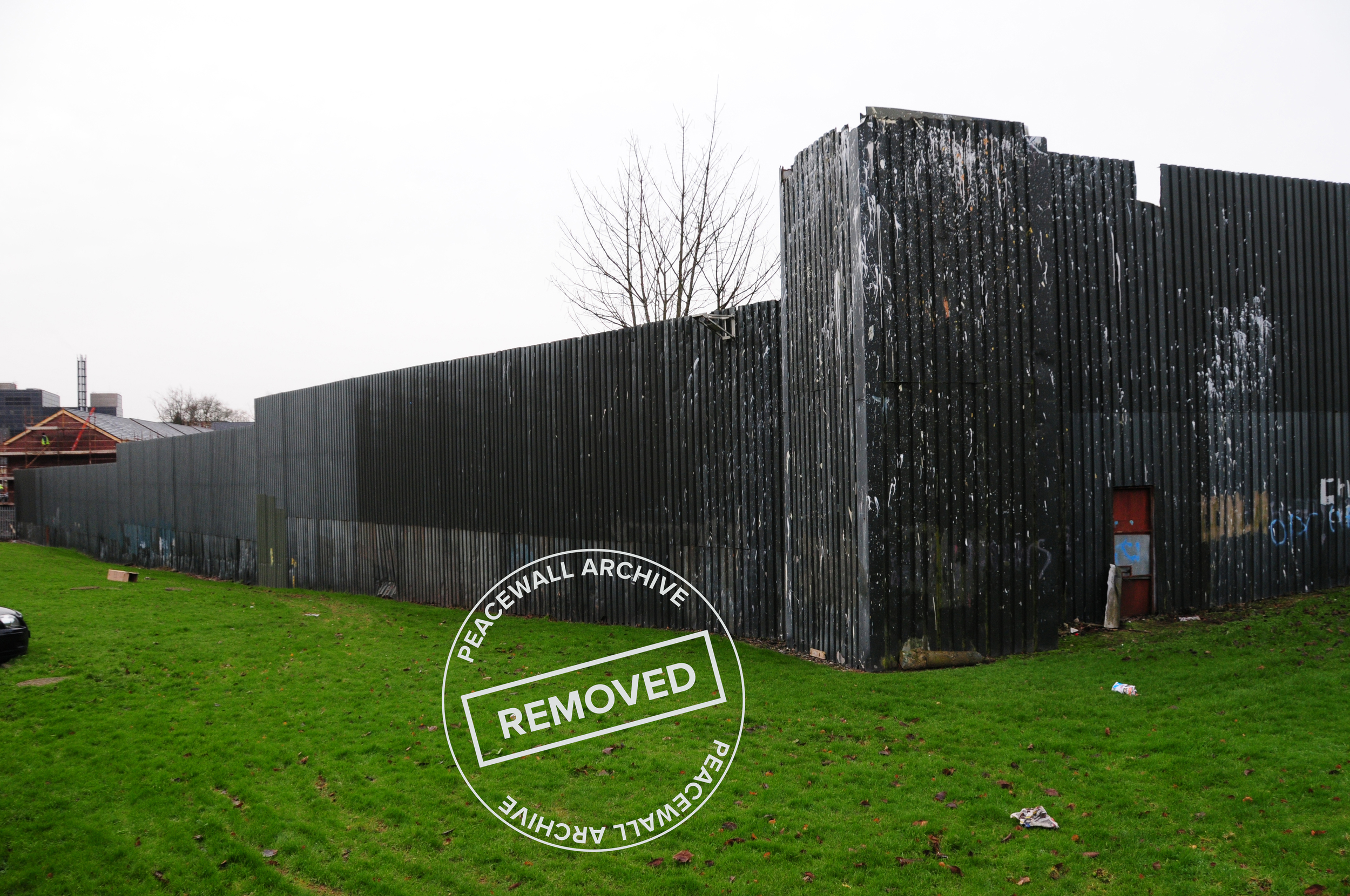
Brucevale Park
3.1.1 Reference code(s)
UK INT-ARC PA2015 CL08-P0011
3.1.2 Title
Photograph of works before removal of Interface Barriers at Brucevale Park and Kinnaird Close
3.1.3 Cluster
BIP Interface Cluster 08: Lower Oldpark / Manor Street
3.1.4 Owner
NI Department for Social Development
3.1.5 Year built:
1970s
3.1.6 Type
Removal of 5 metre high sheet metal barrier
3.2.1 Date of description
2015
3.2.2 Level of description
Items
3.2.3 Extent and Medium
Digital Image - 4288 × 2848 NIKON D300 Colour
3.2.4 Name of creator(s)
© James O'Leary
3.2.5 Archival History
Archived on December 11, 2015
3.4.1 Conditions of access
No restrictions on access. Reproduction requires permission.
Duncairn Gardens
3.1.1 Reference code(s)
UK INT-ARC PA2015 CL06-P0001
3.1.2 Title
Photograph of Interface Barrier at Duncairn Gardens from east side looking north.
3.1.3 Cluster
BIP Interface Cluster 06: Duncairn Gardens
3.1.4 Owner
NI Department of Justice
3.1.5 Year built:
1970s
3.1.6 Type
A steel and sheet metal barrier, up to 4 metres high.
3.2.1 Date of description
2014
3.2.2 Level of description
Items
3.2.3 Extent and Medium
Digital Image - 4288 × 2848 NIKON D300 Colour
3.2.4 Name of creator(s)
© James O'Leary
3.2.5 Archival History
Archived on June 5, 2015
3.4.1 Conditions of access
No restrictions on access. Reproduction requires permission.
Glenbryn Park
3.1.1 Reference code(s)
UK INT-ARC PA2015 CL09-P0009
3.1.2 Title
Photograph of Interface Barrier at Alliance Avenue from Ardoyne side
3.1.3 Cluster
BIP Interface Cluster 09: Ardoyne-Glenbryn
3.1.4 Owner
NI Department of Justice
3.1.5 Year built:
1991 & 2003
3.1.6 Type
A steel and sheet metal barrier, up to 9 metres high.
3.2.1 Date of description
2014
3.2.2 Level of description
Items
3.2.3 Extent and Medium
Digital Image - 4288 × 2848 NIKON D300 Colour
3.2.4 Name of creator(s)
© James O'Leary
3.2.5 Archival History
Archived on June 5, 2015
3.4.1 Conditions of access
No restrictions on access. Reproduction requires permission.
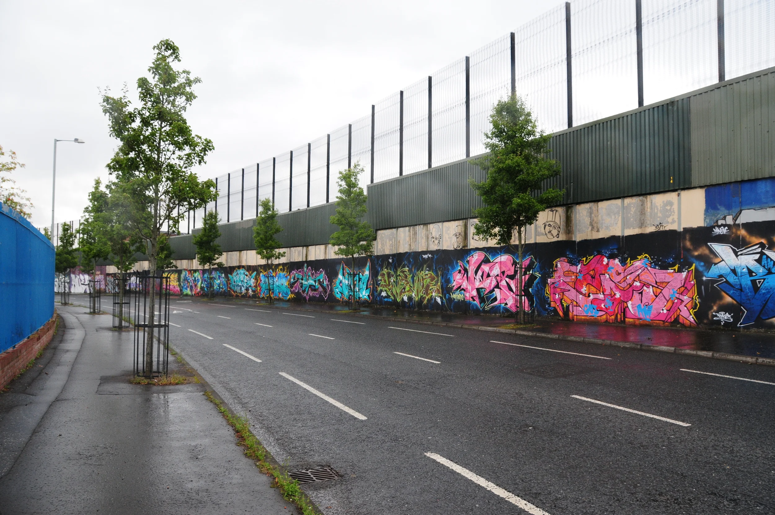
Bryson Street
3.1.1 Reference code(s)
UK INT-ARC PA2015 CL12-P0003
3.1.2 Title
Photograph of Interface Barrier at Bryson Street looking west
3.1.3 Cluster
BIP Interface Cluster 12: Short Strand / Inner East
3.1.4 Owner
NI Department of Justice (Maintained by NI Housing Executive)
3.1.5 Year built:
1970s & 2003
3.1.6 Type
A brick wall with mesh fencing above, to a total height of 7.5 metres, 275 metres long.
3.2.1 Date of description
2014
3.2.2 Level of description
Items
3.2.3 Extent and Medium
Digital Image - 4288 × 2848 NIKON D300 Colour
3.2.4 Name of creator(s)
© James O'Leary
3.2.5 Archival History
Archived on June 5, 2015
3.4.1 Conditions of access
No restrictions on access. Reproduction requires permission.
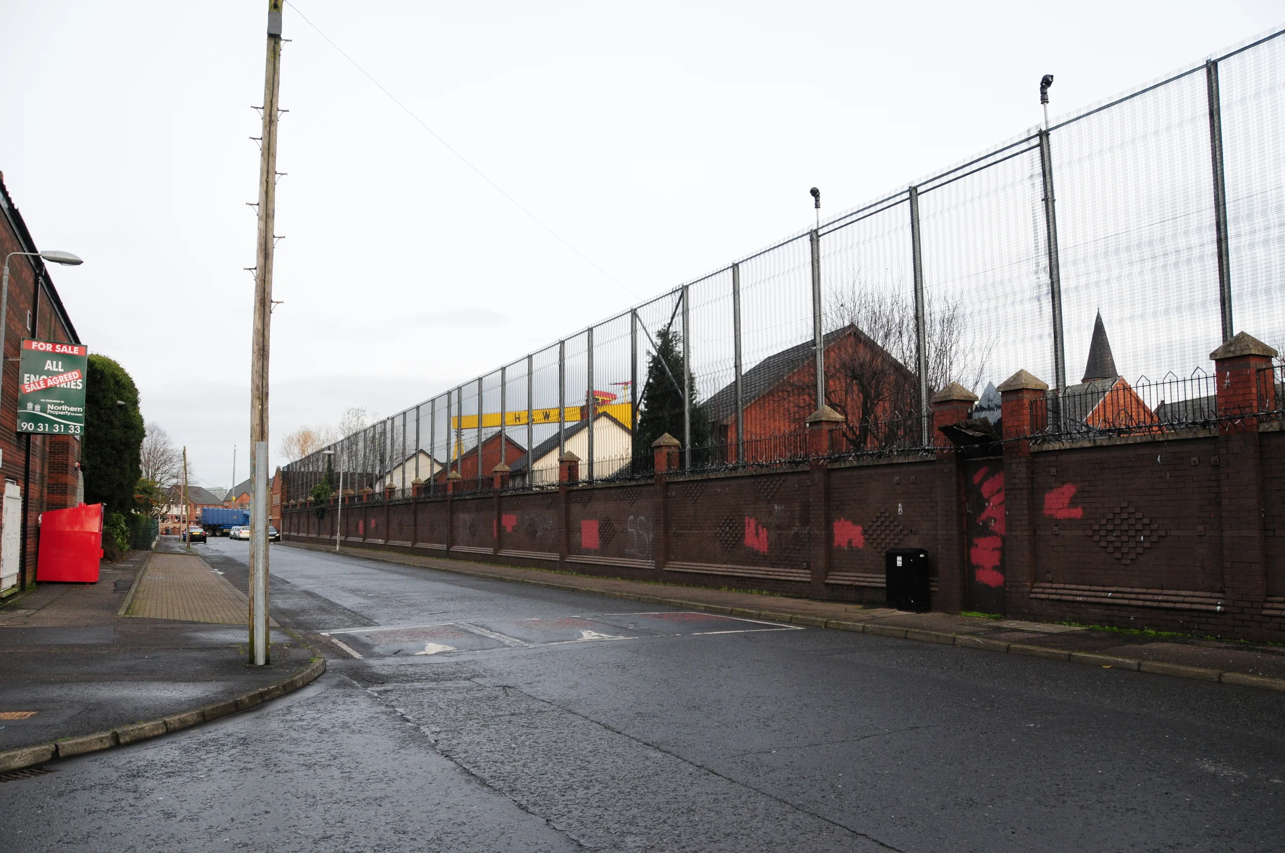
North Howard Street
3.1.1 Reference code(s)
UK INT-ARC PA2015 CL03-P0001
3.1.2 Title
Photograph of Interface Barrier at North Howard Street from east side looking north.
3.1.3 Cluster
BIP Interface Cluster 03: Falls / Shankill
3.1.4 Owner
NI Department of Justice
3.1.5 Year built:
1969
3.1.6 Type
A multi-level barrier of 4.5 metre concrete wall with 3 metre high metal sheet and 6 metre high open mesh, 800 metres long
3.2.1 Date of description
2014
3.2.2 Level of description
Items
3.2.3 Extent and Medium
Digital Image - 4288 × 2848 NIKON D300 Colour
3.2.4 Name of creator(s)
© James O'Leary
3.2.5 Archival History
Archived on June 5, 2015
3.4.1 Conditions of access
No restrictions on access. Reproduction requires permission.

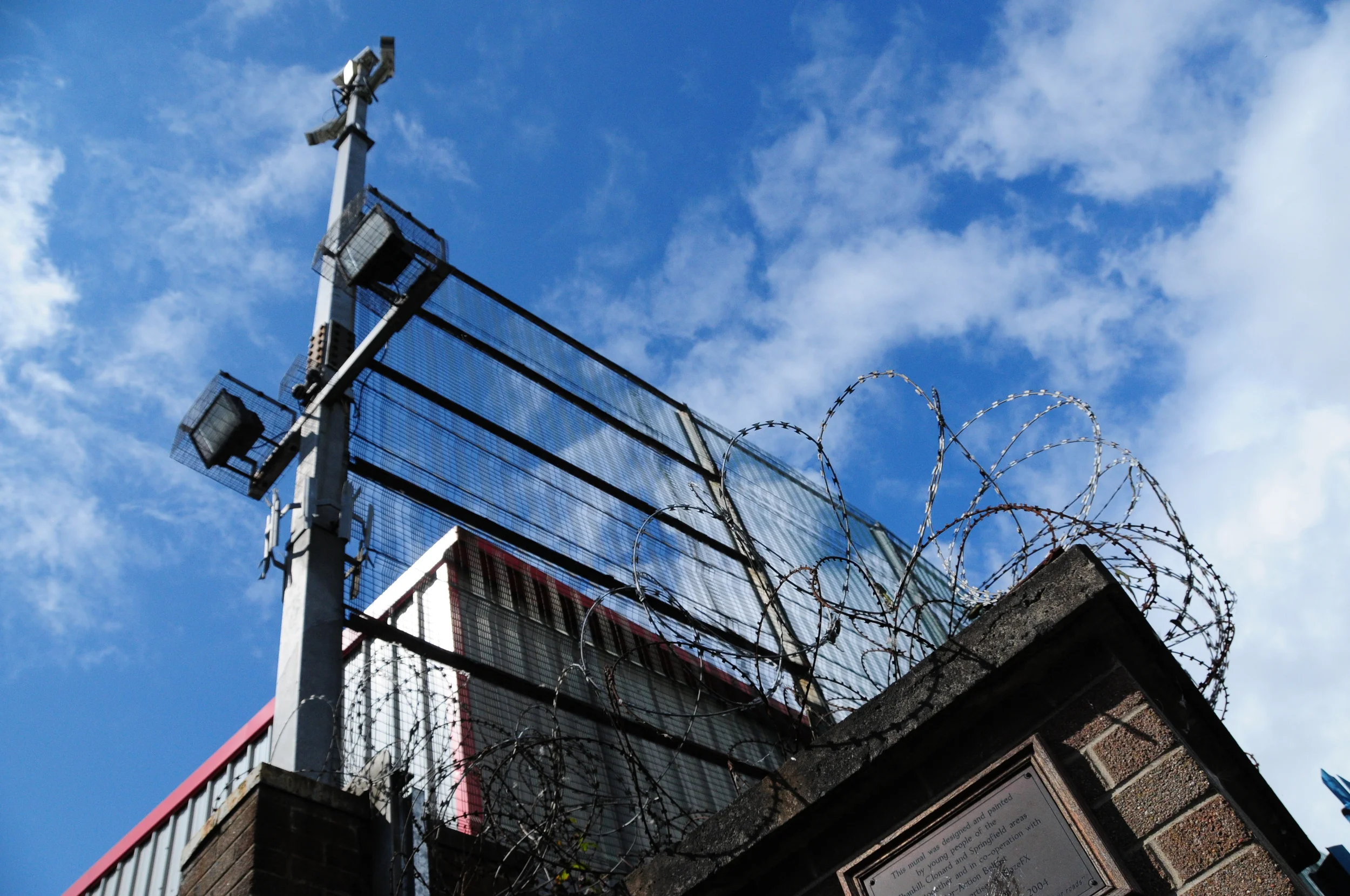
Lanark Way
3.1.1 Reference code(s)
UK INT-ARC PA2015 CL03-P0006
3.1.2 Title
Photograph of Interface Barrier Gate at Lanark Way from east side.
3.1.3 Cluster
BIP Interface Cluster 03: Falls / Shankill
3.1.4 Owner
NI Department of Justice
3.1.5 Year built:
1988
3.1.6 Type
Electronically controlled metal gates, 4 metres highland and 10 metres wide, topped with open metal mesh fencing, razor wire and video surveillance systems controls access to Lanark Way from Springfield Road.
3.2.1 Date of description
2014
3.2.2 Level of description
Items
3.2.3 Extent and Medium
Digital Image - 4288 × 2848 NIKON D300 Colour
3.2.4 Name of creator(s)
© James O'Leary
3.2.5 Archival History
Archived on June 5, 2015
3.4.1 Conditions of access
No restrictions on access. Reproduction requires permission.
Cupar Way
3.1.1 Reference code(s)
UK INT-ARC PA2015 CL03-P0002
3.1.2 Title
Photograph of Interface Barrier at Cupar Way from east side looking south.
3.1.3 Cluster
BIP Interface Cluster 03: Falls / Shankill
3.1.4 Owner
NI Department of Justice
3.1.5 Year built:
1969
3.1.6 Type
A multi-level barrier of 4.5 metre concrete wall with 3 metre high metal sheet and 6 metre high open mesh, 800 metres long.
3.2.1 Date of description
2014
3.2.2 Level of description
Items
3.2.3 Extent and Medium
Digital Image - 4288 × 2848 NIKON D300 Colour
3.2.4 Name of creator(s)
© James O'Leary
3.2.5 Archival History
Archived on June 5, 2015
3.4.1 Conditions of access
No restrictions on access. Reproduction requires permission.
Cupar Way
3.1.1 Reference code(s)
UK INT-ARC PA2015 CL03-P0003
3.1.2 Title
Photograph of Interface Barrier at Cupar Way from east side looking south.
3.1.3 Cluster
BIP Interface Cluster 03: Falls / Shankill
3.1.4 Owner
NI Department of Justice
3.1.5 Year built:
1969
3.1.6 Type
A multi-level barrier of 4.5 metre concrete wall with 3 metre high metal sheet and 6 metre high open mesh, 800 metres long
3.2.1 Date of description
2014
3.2.2 Level of description
Items
3.2.3 Extent and Medium
Digital Image - 4288 × 2848 NIKON D300 Colour
3.2.4 Name of creator(s)
© James O'Leary
3.2.5 Archival History
Archived on June 5, 2015
3.4.1 Conditions of access
No restrictions on access. Reproduction requires permission.
Cupar Way
3.1.1 Reference code(s)
UK INT-ARC PA2015 CL03-P0004
3.1.2 Title
Photograph of Interface Barrier at Cupar Way from east side looking north.
3.1.3 Cluster
BIP Interface Cluster 03: Falls / Shankill
3.1.4 Owner
NI Department of Justice
3.1.5 Year built:
1969
3.1.6 Type
A multi-level barrier of 4.5 metre concrete wall with 3 metre high metal sheet and 6 metre high open mesh, 800 metres long.
3.2.1 Date of description
2014
3.2.2 Level of description
Items
3.2.3 Extent and Medium
Digital Image - 4288 × 2848 NIKON D300 Colour
3.2.4 Name of creator(s)
© James O'Leary
3.2.5 Archival History
Archived on June 5, 2015
3.4.1 Conditions of access
No restrictions on access. Reproduction requires permission.
Springfield Road
3.1.1 Reference code(s)
UK INT-ARC PA2015 CL02-P0003
3.1.2 Title
Photograph of Interface Barrier at Springfield Road, which forms part of the perimeter for the New Barnsley PSNI station.
3.1.3 Cluster
BIP Interface Cluster 02: Upper Springfield Road
3.1.4 Owner
NI Department of Justice
3.1.5 Year built:
1990 & 1994
3.1.6 Type
A three meter high brick wall with a 2.4 metre high sheet metal fence, with a buffer zone on either side of the wall.
3.2.1 Date of description
2015
3.2.2 Level of description
Items
3.2.3 Extent and Medium
Digital Image - 4288 × 2848 NIKON D300 Colour
3.2.4 Name of creator(s)
© James O'Leary
3.2.5 Archival History
Archived on December 10, 2015
3.4.1 Conditions of access
No restrictions on access. Reproduction requires permission.
Bryson Street
3.1.1 Reference code(s)
UK INT-ARC PA2015 CL12-P0005
3.1.2 Title
Photograph of Interface Barrier at Bryson Street looking east.
3.1.3 Cluster
BIP Interface Cluster 12: Short Strand / Inner East
3.1.4 Owner
NI Department of Justice (Maintained by NI Housing Executive)
3.1.5 Year built:
1970s & 2003
3.1.6 Type
A brick wall with anti-climb metal prongs, with metal mesh fencing above, to a total height of 7.5 metres, 275 metres long.
3.2.1 Date of description
2014
3.2.2 Level of description
Items
3.2.3 Extent and Medium
Digital Image - 4288 × 2848 NIKON D300 Colour
3.2.4 Name of creator(s)
© James O'Leary
3.2.5 Archival History
Archived on June 5, 2015
3.4.1 Conditions of access
No restrictions on access. Reproduction requires permission.
3.1.1 Reference code(s)
UK INT-ARC PA2015 CL03-P0006
3.1.2 Title
Photograph of Interface Barrier Gate at Lanark Way from east side.
3.1.3 Cluster
BIP Interface Cluster 03: Falls / Shankill
3.1.4 Owner
NI Department of Justice
3.1.5 Year built:
1988
3.1.6 Type
Electronically controlled metal gates, 4 metres highland and 10 metres wide, topped with open metal mesh fencing, razor wire and video surveillance systems controls access to Lanark Way from Springfield Road.
3.2.1 Date of description
2014
3.2.2 Level of description
Items
3.2.3 Extent and Medium
Digital Image - 4288 × 2848 NIKON D300 Colour
3.2.4 Name of creator(s)
© James O'Leary
3.2.5 Archival History
Archived on June 5, 2015
3.4.1 Conditions of access
No restrictions on access. Reproduction requires permission.
Brucevale Park
3.1.1 Reference code(s)
UK INT-ARC PA2015 CL08-P0011
3.1.2 Title
Photograph of works during removal of Interface Barriers at Brucevale Park
3.1.3 Cluster
BIP Interface Cluster 08: Lower Oldpark / Manor Street
3.1.4 Owner
NI Department for Social Development
3.1.5 Year built:
1970s
3.1.6 Type
Removal of 5 metre high sheet metal barrier
3.2.1 Date of description
2015
3.2.2 Level of description
Items
3.2.3 Extent and Medium
Digital Image - 4288 × 2848 NIKON D300 Colour
3.2.4 Name of creator(s)
© James O'Leary
3.2.5 Archival History
Archived on December 11, 2015
3.4.1 Conditions of access
No restrictions on access. Reproduction requires permission.
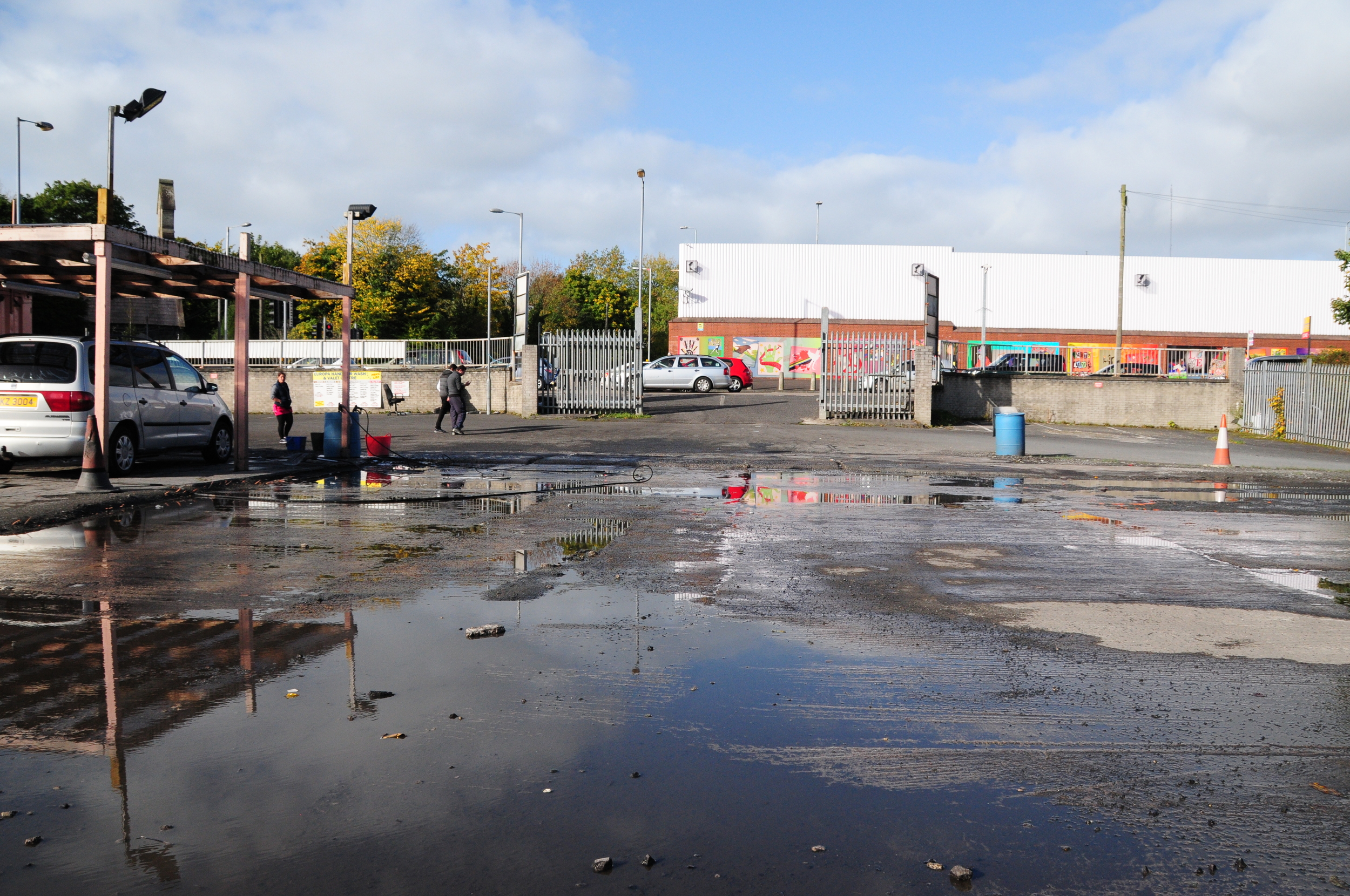
Alloa Street
3.1.1 Reference code(s)
UK INT-ARC PA2015 CL08-P0001
3.1.2 Title
Photograph of Interface Barrier at Rosevale Street from west side at Alloa Street
3.1.3 Cluster
BIP Interface Cluster 08: Lower Oldpark / Manor Street
3.1.4 Owner
NI Department of Justice
3.1.5 Year built:
1980s
3.1.6 Type
A steel and metal sheet barrier, 200 metres long and 4 metres high.
3.2.1 Date of description
2014
3.2.2 Level of description
Items
3.2.3 Extent and Medium
Digital Image - 4288 × 2848 NIKON D300 Colour
3.2.4 Name of creator(s)
© James O'Leary
3.2.5 Archival History
Archived on June 5, 2015
3.4.1 Conditions of access
No restrictions on access. Reproduction requires permission.
Alloa Street
3.1.1 Reference code(s)
UK INT-ARC PA2015 CL08-P0003
3.1.2 Title
Photograph of Interface Barrier at Alloa Street and Cliftonpark Avenue from north side
3.1.3 Cluster
BIP Interface Cluster 08: Lower Oldpark / Manor Street
3.1.4 Owner
NI Department for Social Development
3.1.5 Year built:
1978
3.1.6 Type
A steel and sheet metal barrier, topped with open mesh in places, up to 5 metres high.
3.2.1 Date of description
2014
3.2.2 Level of description
Items
3.2.3 Extent and Medium
Digital Image - 4288 × 2848 NIKON D300 Colour
3.2.4 Name of creator(s)
© James O'Leary
3.2.5 Archival History
Archived on June 5, 2015
3.4.1 Conditions of access
No restrictions on access. Reproduction requires permission.
3.1.1 Reference code(s)
UK INT-ARC PA2015 CL03-P0001
3.1.2 Title
Photograph of Interface Barrier at Rosevale Street from west side at Manor Street
3.1.3 Cluster
BIP Interface Cluster 03: Falls / Shankill
3.1.4 Owner
NI Department of Justice
3.1.5 Year built:
1988 & 2003
3.1.6 Type
A steel and open metal mesh barrier, 6 metres high.
3.2.1 Date of description
2014
3.2.2 Level of description
Items
3.2.3 Extent and Medium
Digital Image - 4288 × 2848 NIKON D300 Colour
3.2.4 Name of creator(s)
© James O'Leary
3.2.5 Archival History
Archived on June 5, 2015
3.4.1 Conditions of access
No restrictions on access. Reproduction requires permission.
Manor Street
3.1.1 Reference code(s)
UK INT-ARC PA2015 CL08-P0001
3.1.2 Title
Photograph of Interface Barrier at Rosevale Street from west side at Manor Street
3.1.3 Cluster
BIP Interface Cluster 08: Lower Oldpark / Manor Street
3.1.4 Owner
NI Department of Justice
3.1.5 Year built:
1980s
3.1.6 Type
A steel and metal sheet barrier, 200 metres long and 4 metres high.
3.2.1 Date of description
2014
3.2.2 Level of description
Items
3.2.3 Extent and Medium
Digital Image - 4288 × 2848 NIKON D300 Colour
3.2.4 Name of creator(s)
© James O'Leary
3.2.5 Archival History
Archived on June 5, 2015
3.4.1 Conditions of access
No restrictions on access. Reproduction requires permission.
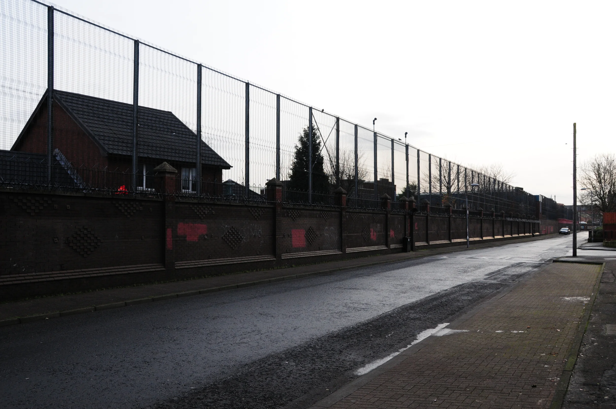
Crumlin Road
3.1.1 Reference code(s)
UK INT-ARC PA2015 CL09-P0002
3.1.2 Title
Photograph of Interface Barrier closing off access to Flax Street from Crumlin Road.
3.1.3 Cluster
BIP Interface Cluster 09: Ardoyne-Glenbryn
3.1.4 Owner
NI Department of Justice
3.1.5 Year built:
1994
3.1.6 Type
A palisade fence, 14 metres long and 2.5 metres high
3.2.1 Date of description
2015
3.2.2 Level of description
Items
3.2.3 Extent and Medium
Digital Image - 4288 × 2848 NIKON D300 Colour
3.2.4 Name of creator(s)
© James O'Leary
3.2.5 Archival History
Archived on December 10, 2015
3.4.1 Conditions of access
No restrictions on access. Reproduction requires permission.
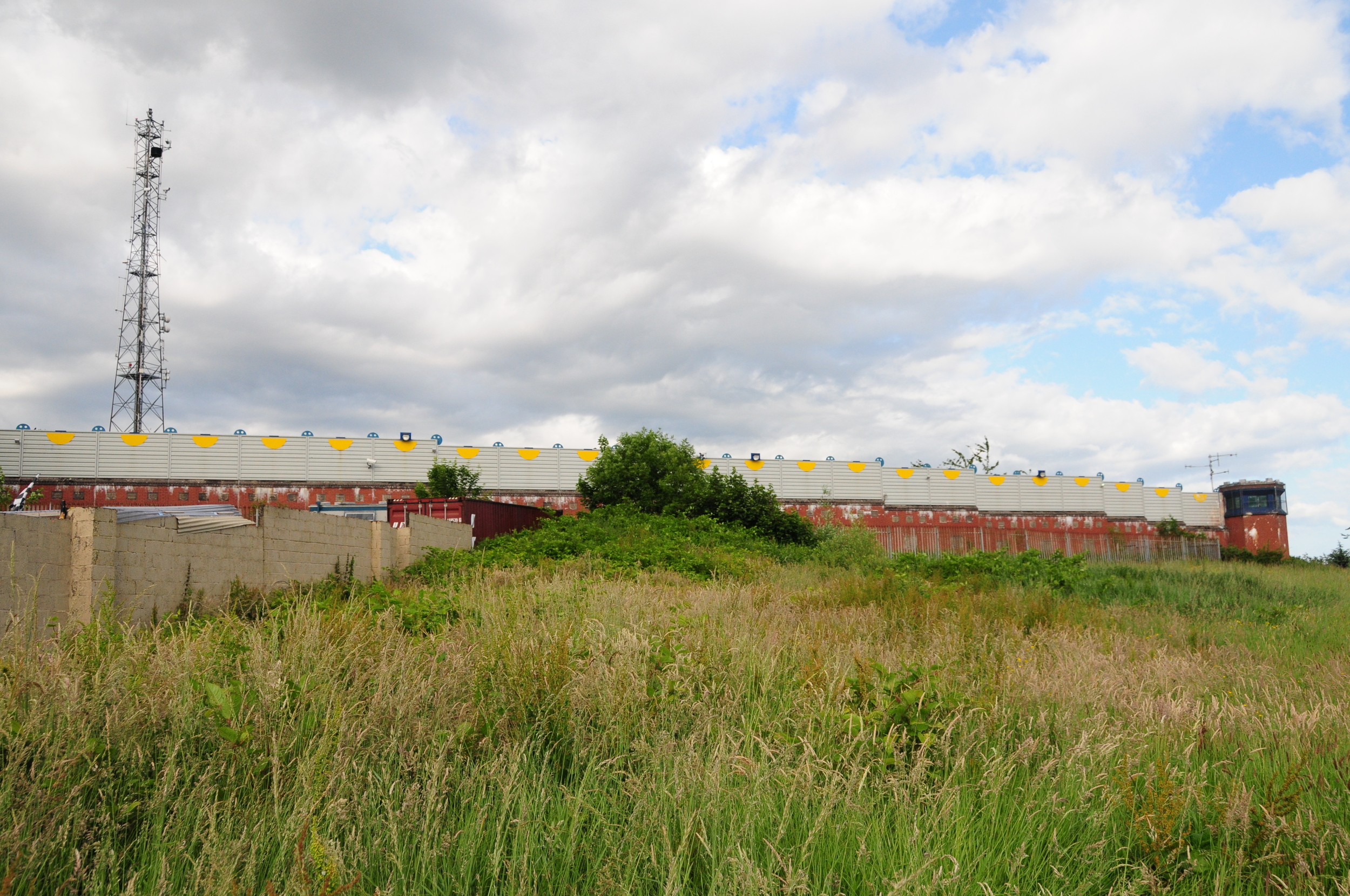
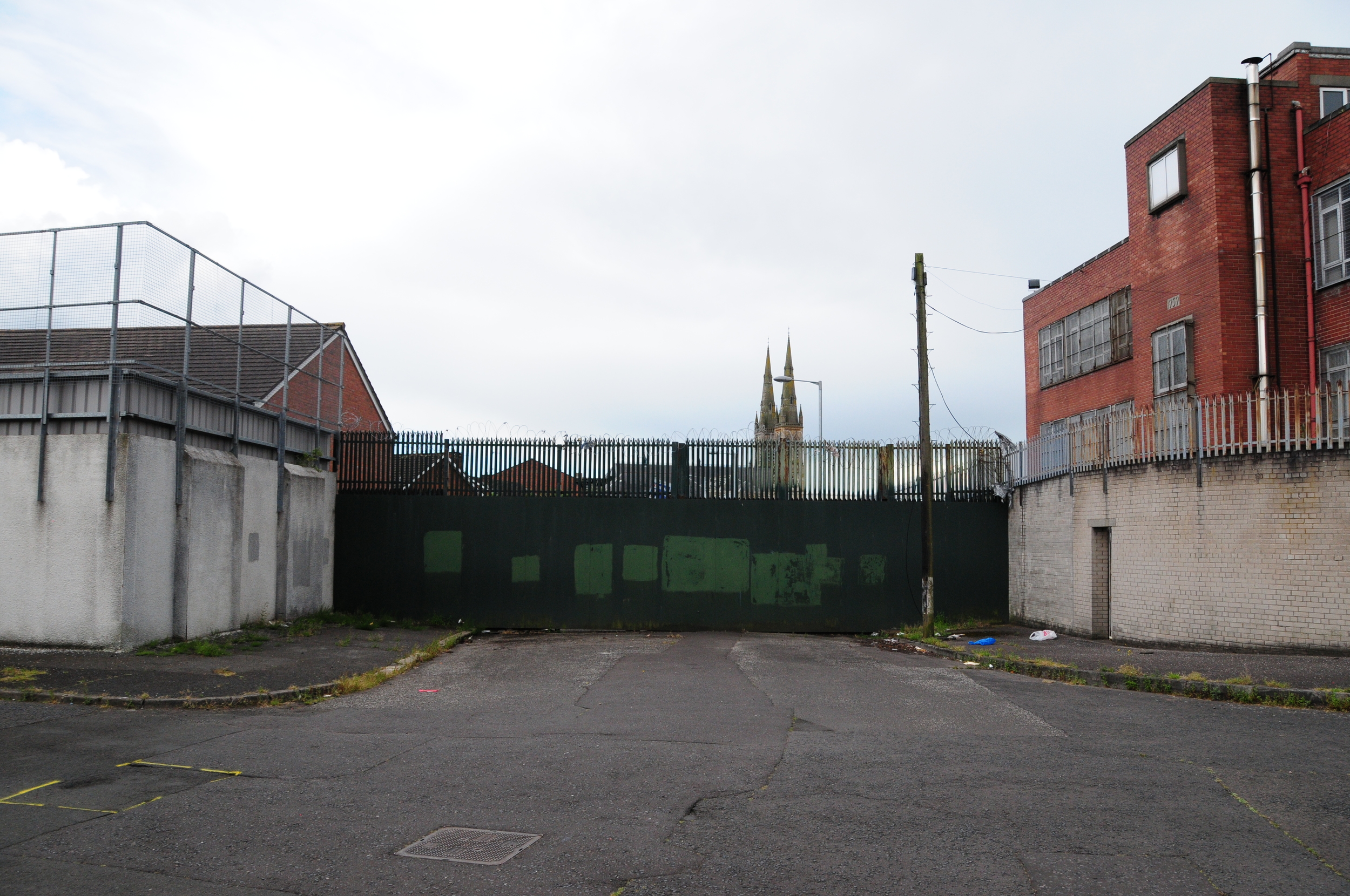
Hillview Road
3.1.1 Reference code(s)
UK INT-ARC PA2015 CL09-P0003
3.1.2 Title
Photograph of Interface Barrier at rear of new housing development at Rosehead Drive, bounding the car park of the former Dunnes Stores site on Crumlin Road.
3.1.3 Cluster
BIP Interface Cluster 09: Ardoyne-Glenbryn
3.1.4 Owner
NI Housing Executive
3.1.5 Year built:
2010
3.1.6 Type
6 metre high brick wall
3.2.1 Date of description
2015
3.2.2 Level of description
Items
3.2.3 Extent and Medium
Digital Image - 4288 × 2848 NIKON D300 Colour
3.2.4 Name of creator(s)
© James O'Leary
3.2.5 Archival History
Archived on December 10, 2015
3.4.1 Conditions of access
No restrictions on access. Reproduction requires permission.
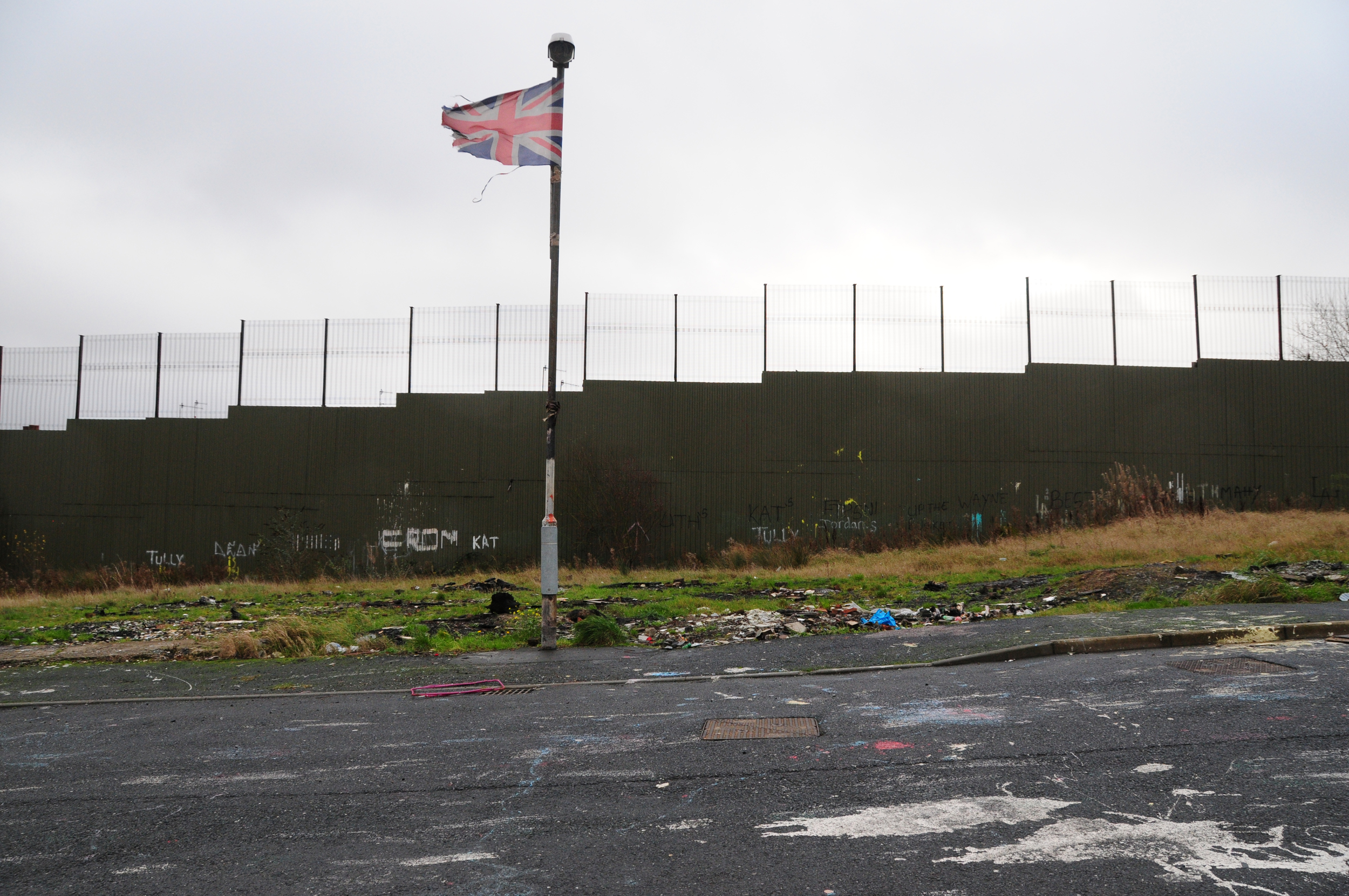
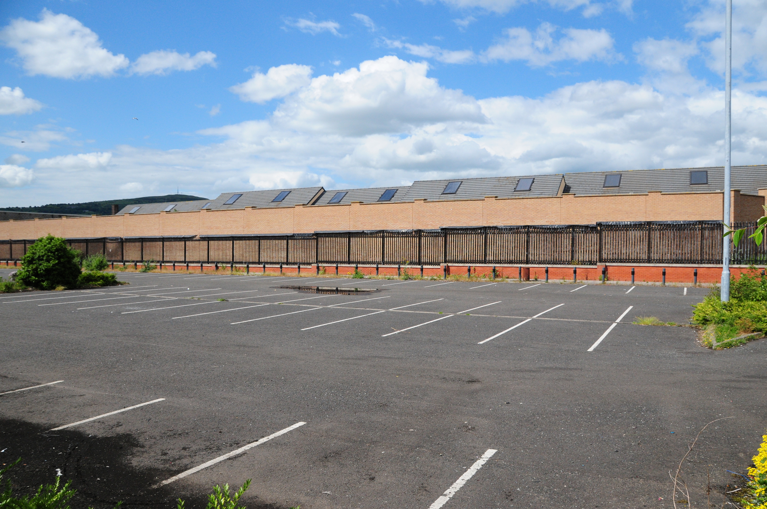
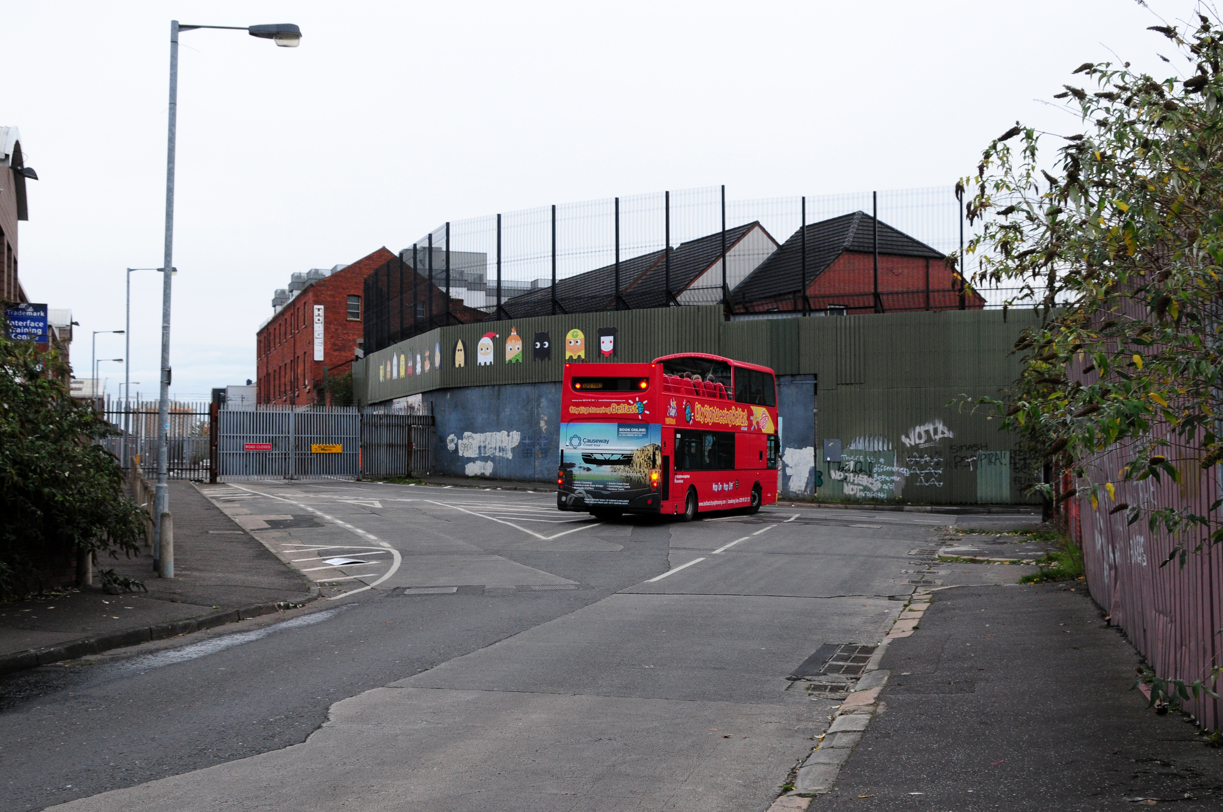
Cliftonpark Avenue
3.1.1 Reference code(s)
UK INT-ARC PA2015 CL08-P0003
3.1.2 Title
Photograph of Interface Barrier at Cliftonpark Avenue from north side. This barrier was built to facilitate the demolition of the Girdwood perimeter, and has subsequently been replaced by 3 meter high palisade fence.
3.1.3 Cluster
BIP Interface Cluster 08: Lower Oldpark / Manor Street
3.1.4 Owner
NI Department for Social Development
3.1.5 Year built:
2015
3.1.6 Type
A sheet metal barrier, reinforced with large concrete blocks, 2 metres high.
3.2.1 Date of description
2015
3.2.2 Level of description
Items
3.2.3 Extent and Medium
Digital Image - 4288 × 2848 NIKON D300 Colour
3.2.4 Name of creator(s)
© James O'Leary
3.2.5 Archival History
Archived on December 10, 2015
3.4.1 Conditions of access
No restrictions on access. Reproduction requires permission.
Madrid Street
3.1.1 Reference code(s)
UK INT-ARC PA2015 CL12-P0005
3.1.2 Title
Photograph of Interface Barrier at Bryson Street and Madrid Street looking east.
3.1.3 Cluster
BIP Interface Cluster 12: Short Strand / Inner East
3.1.4 Owner
NI Department of Justice (Maintained by NI Housing Executive)
3.1.5 Year built:
1970s & 2003
3.1.6 Type
A brick wall with anti-climb metal prongs, with metal mesh fencing above, to a total height of 7.5 metres, 275 metres long.
3.2.1 Date of description
2014
3.2.2 Level of description
Items
3.2.3 Extent and Medium
Digital Image - 4288 × 2848 NIKON D300 Colour
3.2.4 Name of creator(s)
© James O'Leary
3.2.5 Archival History
Archived on June 5, 2015
3.4.1 Conditions of access
No restrictions on access. Reproduction requires permission.
Springmartin Road
3.1.1 Reference code(s)
UK INT-ARC PA2015 CL02-P0001
3.1.2 Title
Photograph of Interface Barrier at Springmartin Road, which forms part of the perimeter for the New Barnsley PSNI station.
3.1.3 Cluster
BIP Interface Cluster 02: Upper Springfield Road
3.1.4 Owner
NI Department of Justice
3.1.5 Year built:
1990 & 1994
3.1.6 Type
A three meter high brick wall with a 2.4 metre high sheet metal fence, with a buffer zone on either side of the wall.
3.2.1 Date of description
2015
3.2.2 Level of description
Items
3.2.3 Extent and Medium
Digital Image - 4288 × 2848 NIKON D300 Colour
3.2.4 Name of creator(s)
© James O'Leary
3.2.5 Archival History
Archived on December 10, 2015
3.4.1 Conditions of access
No restrictions on access. Reproduction requires permission.
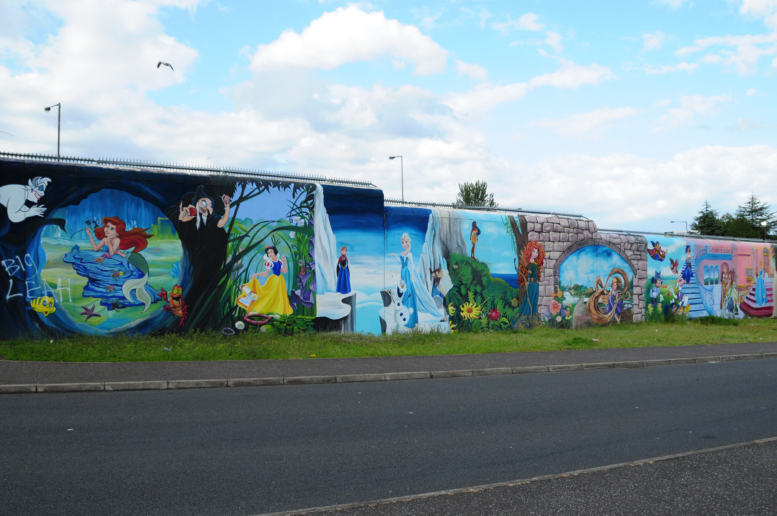
Sliabh Dubh View
3.1.1 Reference code(s)
UK INT-ARC PA2015 CL02-P0004
3.1.2 Title
Photograph of Interface Barrier at Sliabh Dubh View, painted with cartoon characters.
3.1.3 Cluster
BIP Interface Cluster 02: Upper Springfield Road
3.1.4 Owner
Unknown
3.1.5 Year built:
Unknown
3.1.6 Type
A three meter high brick wall with metal anti-climb rail.
3.2.1 Date of description
2015
3.2.2 Level of description
Items
3.2.3 Extent and Medium
Digital Image - 4288 × 2848 NIKON D300 Colour
3.2.4 Name of creator(s)
© James O'Leary
3.2.5 Archival History
Archived on December 10, 2015
3.4.1 Conditions of access
No restrictions on access. Reproduction requires permission.
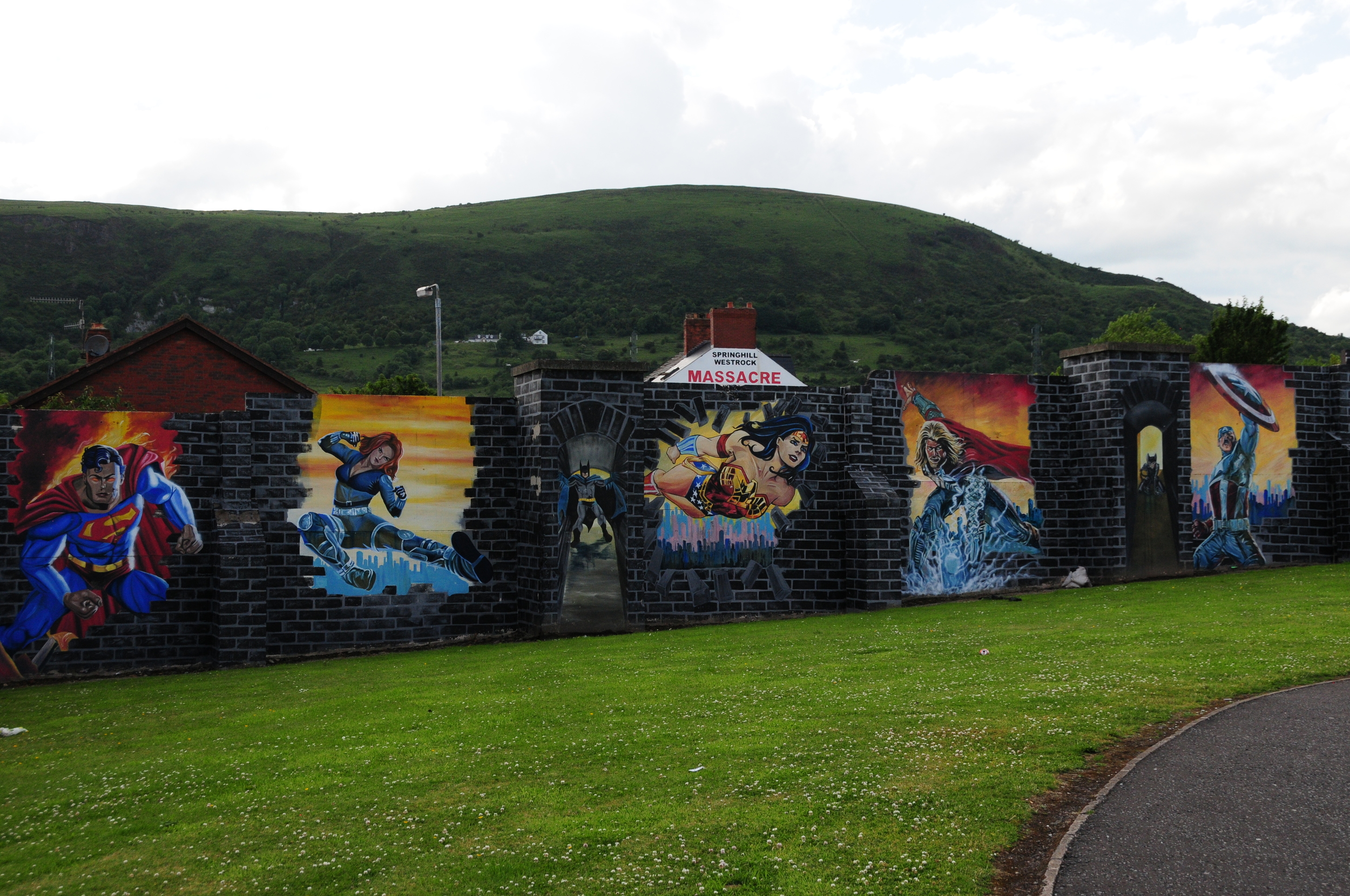
Upper Ballygomartin Road
3.1.1 Reference code(s)
UK INT-ARC PA2015 CL02-P0004
3.1.2 Title
Photograph of Interface Barrier at Upper Ballygomartin Road.
3.1.3 Cluster
BIP Interface Cluster 02: Upper Springfield Road
3.1.4 Owner
Department of Justice
3.1.5 Year built:
1990s
3.1.6 Type
A 2.5 meter high sheet metal fence
3.2.1 Date of description
2015
3.2.2 Level of description
Items
3.2.3 Extent and Medium
Digital Image - 4288 × 2848 NIKON D300 Colour
3.2.4 Name of creator(s)
© James O'Leary
3.2.5 Archival History
Archived on December 10, 2015
3.4.1 Conditions of access
No restrictions on access. Reproduction requires permission.
Moyard Parade
3.1.1 Reference code(s)
UK INT-ARC PA2015 CL02-P0005
3.1.2 Title
Photograph of Interface Barrier at rear of Moyard Parade.
3.1.3 Cluster
BIP Interface Cluster 02: Upper Springfield Road
3.1.4 Owner
NI Department of Justice
3.1.5 Year built:
1991
3.1.6 Type
A palisade fence 3.6 metres high 300 metres long
3.2.1 Date of description
2015
3.2.2 Level of description
Items
3.2.3 Extent and Medium
Digital Image - 4288 × 2848 NIKON D300 Colour
3.2.4 Name of creator(s)
© James O'Leary
3.2.5 Archival History
Archived on December 10, 2015
3.4.1 Conditions of access
No restrictions on access. Reproduction requires permission.
New Barnsley Gardens
3.1.1 Reference code(s)
UK INT-ARC PA2015 CL02-P0005
3.1.2 Title
Photograph of Interface Barrier and buffer zone at New Barnsley Gardens.
3.1.3 Cluster
BIP Interface Cluster 02: Upper Springfield Road
3.1.4 Owner
NI Department of Justice
3.1.5 Year built:
1991
3.1.6 Type
A palisade fence 2.5 metres high
3.2.1 Date of description
2015
3.2.2 Level of description
Items
3.2.3 Extent and Medium
Digital Image - 4288 × 2848 NIKON D300 Colour
3.2.4 Name of creator(s)
© James O'Leary
3.2.5 Archival History
Archived on December 10, 2015
3.4.1 Conditions of access
No restrictions on access. Reproduction requires permission.
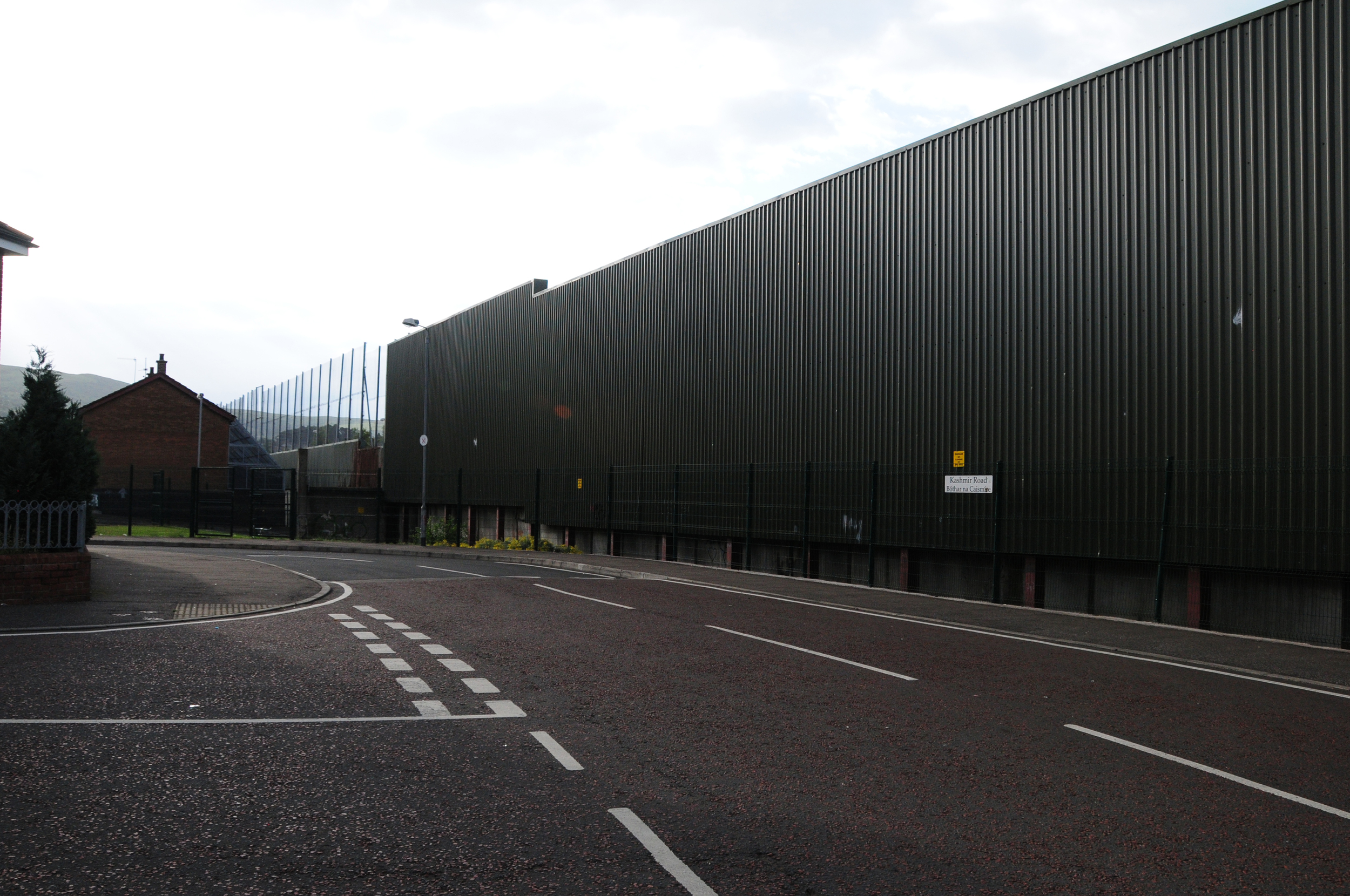
Kashmir Road
3.1.1 Reference code(s)
UK INT-ARC PA2015 CL03-P0004
3.1.2 Title
Photograph of Interface Barrier at Kashmir Road from west side looking northeast.
3.1.3 Cluster
BIP Interface Cluster 03: Falls / Shankill
3.1.4 Owner
NI Department of Justice
3.1.5 Year built:
1969
3.1.6 Type
A multi-level barrier of 4.5 metre concrete wall with 3 metre high metal sheet and 6 metre high open mesh, 800 metres long.
3.2.1 Date of description
2015
3.2.2 Level of description
Items
3.2.3 Extent and Medium
Digital Image - 4288 × 2848 NIKON D300 Colour
3.2.4 Name of creator(s)
© James O'Leary
3.2.5 Archival History
Archived on June 5, 2015
3.4.1 Conditions of access
No restrictions on access. Reproduction requires permission.
Sliabh Dubh View
3.1.1 Reference code(s)
UK INT-ARC PA2015 CL02-P0004
3.1.2 Title
Photograph of Interface Barrier at Sliabh Dubh View, painted with Marvel comic characters.
3.1.3 Cluster
BIP Interface Cluster 02: Upper Springfield Road
3.1.4 Owner
Unknown
3.1.5 Year built:
Unknown
3.1.6 Type
A three meter high brick wall.
3.2.1 Date of description
2015
3.2.2 Level of description
Items
3.2.3 Extent and Medium
Digital Image - 4288 × 2848 NIKON D300 Colour
3.2.4 Name of creator(s)
© James O'Leary
3.2.5 Archival History
Archived on December 10, 2015
3.4.1 Conditions of access
No restrictions on access. Reproduction requires permission.
Bombay Street
3.1.1 Reference code(s)
UK INT-ARC PA2015 CL03-P0005
3.1.2 Title
Photograph of Interface Barrier at rear of Bombay Street looking north, and buffer zone to Interface on Cupar Way.
3.1.3 Cluster
BIP Interface Cluster 03: Falls / Shankill
3.1.4 Owner
NI Department of Justice
3.1.5 Year built:
1969
3.1.6 Type
A multi-level barrier of 4.5 metre concrete wall with 3 metre high metal sheet and 6 metre high open mesh, buffer zone, and mesh cages to rear of properties on Bombay Street.
3.2.1 Date of description
2015
3.2.2 Level of description
Items
3.2.3 Extent and Medium
Digital Image - 4288 × 2848 NIKON D300 Colour
3.2.4 Name of creator(s)
© James O'Leary
3.2.5 Archival History
Archived on June 5, 2015
3.4.1 Conditions of access
No restrictions on access. Reproduction requires permission.
North Howard Street
3.1.1 Reference code(s)
UK INT-ARC PA2015 CL03-P0004
3.1.2 Title
Photograph of Interface Barrier at the junction of Cupar Way and North Howard Street from North Howard Street, looking west.
3.1.3 Cluster
BIP Interface Cluster 03: Falls / Shankill
3.1.4 Owner
NI Department of Justice
3.1.5 Year built:
1969 & 1970s
3.1.6 Type
A multi-level barrier of 4.5 metre concrete wall with 3 metre high metal sheet and 6 metre high open mesh, 800 metres long. A metal gate 3.5 metres high and 7 metres wide closes access to North Howard Street at certain times.
3.2.1 Date of description
2015
3.2.2 Level of description
Items
3.2.3 Extent and Medium
Digital Image - 4288 × 2848 NIKON D300 Colour
3.2.4 Name of creator(s)
© James O'Leary
3.2.5 Archival History
Archived on June 5, 2015
3.4.1 Conditions of access
No restrictions on access. Reproduction requires permission.
Cupar Way
3.1.1 Reference code(s)
UK INT-ARC PA2015 CL03-P0005
3.1.2 Title
Photograph of Interface Barrier at Cupar Way, looking north.
3.1.3 Cluster
BIP Interface Cluster 03: Falls / Shankill
3.1.4 Owner
NI Department of Justice
3.1.5 Year built:
1969 & 1970s
3.1.6 Type
A multi-level barrier of 4.5 metre concrete wall with 3 metre high metal sheet and 6 metre high open mesh, 800 metres long.
3.2.1 Date of description
2015
3.2.2 Level of description
Items
3.2.3 Extent and Medium
Digital Image - 4288 × 2848 NIKON D300 Colour
3.2.4 Name of creator(s)
© James O'Leary
3.2.5 Archival History
Archived on December 10, 2015
3.4.1 Conditions of access
No restrictions on access. Reproduction requires permission.
Beverley Street
3.1.1 Reference code(s)
UK INT-ARC PA2015 CL03-P0006
3.1.2 Title
Photograph of Interface Barrier at Beverley Street, looking west.
3.1.3 Cluster
BIP Interface Cluster 03: Falls / Shankill
3.1.4 Owner
NI Department of Justice
3.1.5 Year built:
1970s
3.1.6 Type
A 3.5 metre high metal gate closes access to Beverley Street, and bounds an industrial zone which forms a buffer between the Falls and the Shankill areas of the city.
3.2.1 Date of description
2015
3.2.2 Level of description
Items
3.2.3 Extent and Medium
Digital Image - 4288 × 2848 NIKON D300 Colour
3.2.4 Name of creator(s)
© James O'Leary
3.2.5 Archival History
Archived on December 10, 2015
3.4.1 Conditions of access
No restrictions on access. Reproduction requires permission.
Brucevale Park
3.1.1 Reference code(s)
UK INT-ARC PA2015 CL08-P0002
3.1.2 Title
Photograph of Interface Barrier at Brucevale Park from east side
3.1.3 Cluster
BIP Interface Cluster 08: Lower Oldpark / Manor Street
3.1.4 Owner
NI Department for Social Development
3.1.5 Year built:
1978
3.1.6 Type
A steel and sheet metal barrier, topped with open mesh in places, up to 5 metres high.
3.2.1 Date of description
2014
3.2.2 Level of description
Items
3.2.3 Extent and Medium
Digital Image - 4288 × 2848 NIKON D300 Colour
3.2.4 Name of creator(s)
© James O'Leary
3.2.5 Archival History
Archived on June 5, 2015
3.4.1 Conditions of access
No restrictions on access. Reproduction requires permission.
Beverley Street
3.1.1 Reference code(s)
UK INT-ARC PA2015 CL03-P0007
3.1.2 Title
Photograph of Interface Barrier at Beverley Street, looking southwest.
3.1.3 Cluster
BIP Interface Cluster 03: Falls / Shankill
3.1.4 Owner
NI Department of Justice
3.1.5 Year built:
1970s
3.1.6 Type
An 8 meter high barrier comprised of a concrete wall with sheet metal fencing above propped with steel struts and steel framed open mesh fencing on top
3.2.1 Date of description
2015
3.2.2 Level of description
Items
3.2.3 Extent and Medium
Digital Image - 4288 × 2848 NIKON D300 Colour
3.2.4 Name of creator(s)
© James O'Leary
3.2.5 Archival History
Archived on December 10, 2015
3.4.1 Conditions of access
No restrictions on access. Reproduction requires permission.
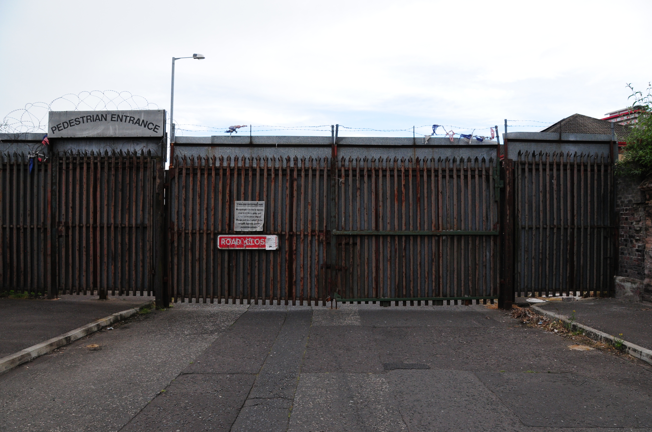
Townsend Street
3.1.1 Reference code(s)
UK INT-ARC PA2015 CL03-P0008
3.1.2 Title
Photograph of Interface Barrier at Townsend Street, looking south.
3.1.3 Cluster
BIP Interface Cluster 03: Falls / Shankill
3.1.4 Owner
NI Department of Justice
3.1.5 Year built:
1992
3.1.6 Type
Metal gates, 2.5 metres high and 12 metres wide are used to close north-south vehicle and pedestrian access at certain times.
3.2.1 Date of description
2015
3.2.2 Level of description
Items
3.2.3 Extent and Medium
Digital Image - 4288 × 2848 NIKON D300 Colour
3.2.4 Name of creator(s)
© James O'Leary
3.2.5 Archival History
Archived on December 10, 2015
3.4.1 Conditions of access
No restrictions on access. Reproduction requires permission.
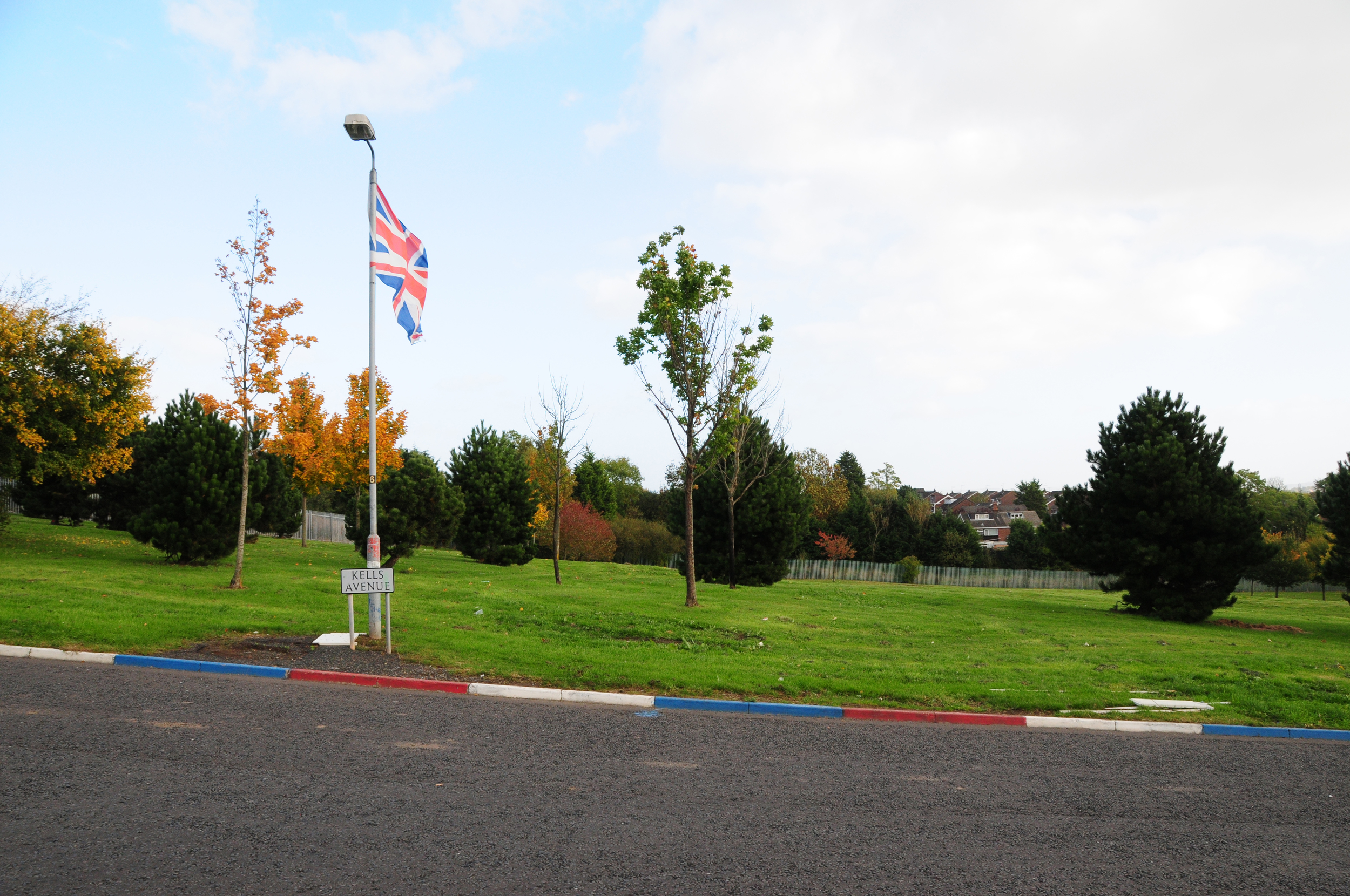
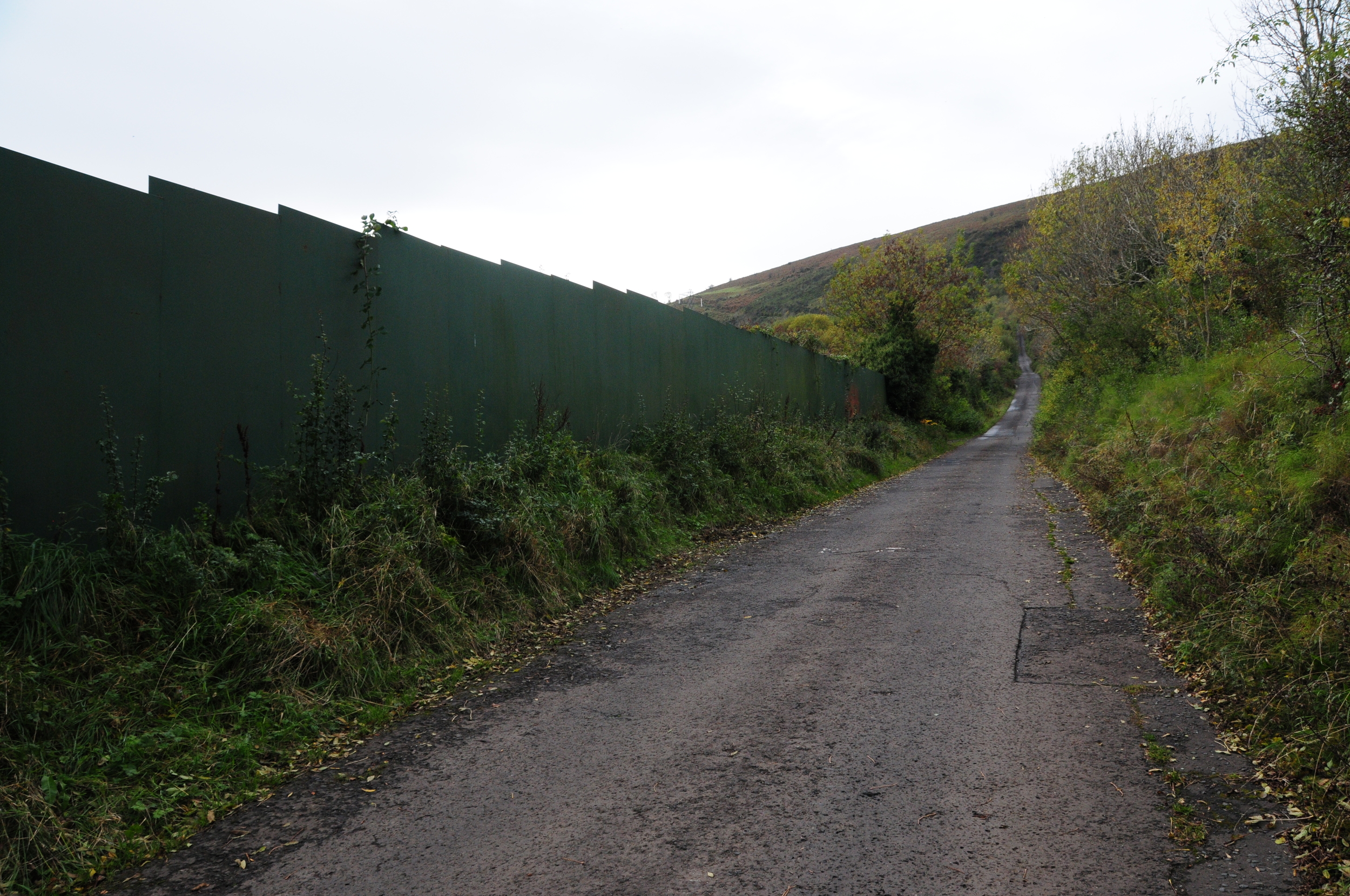
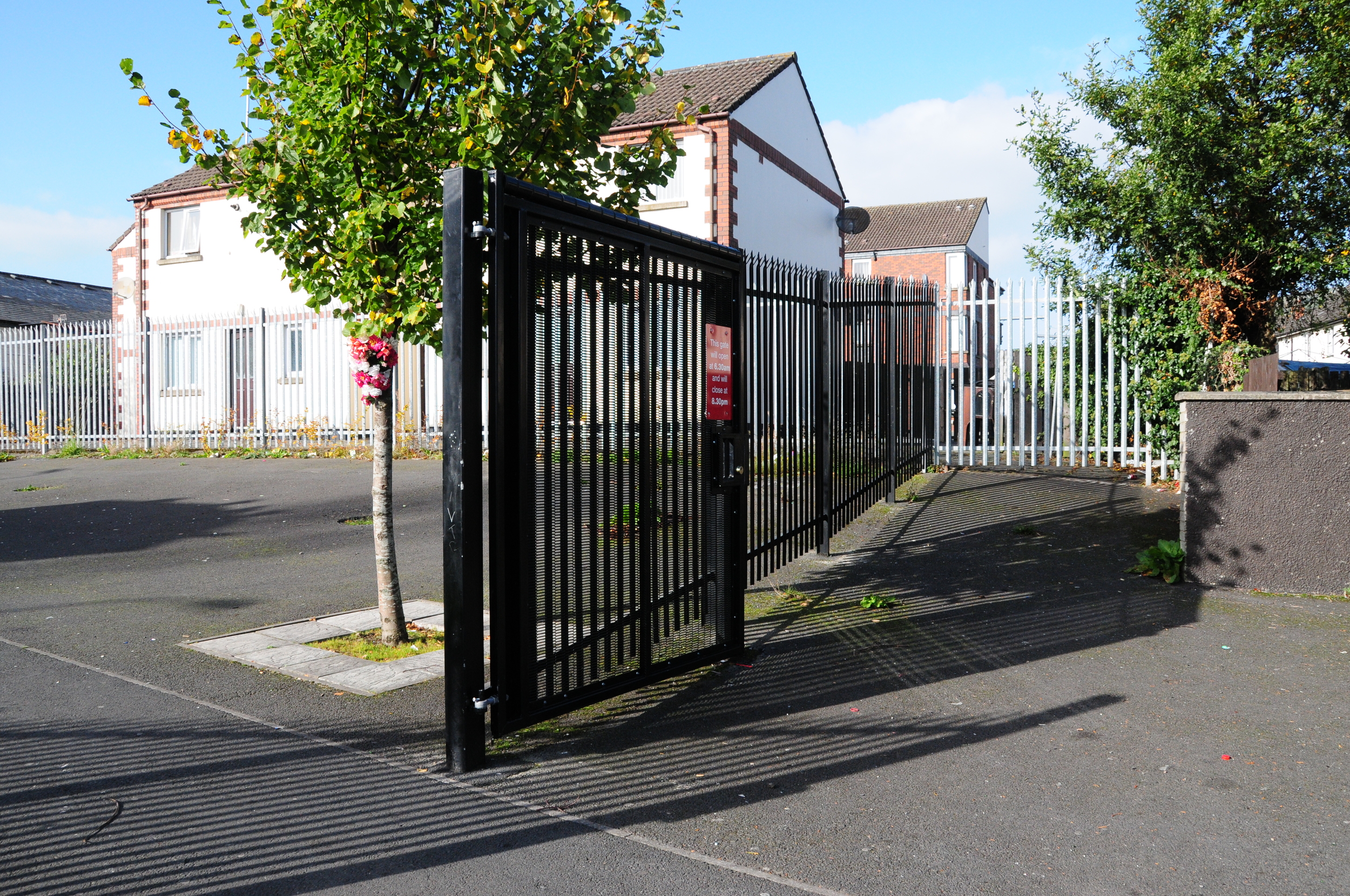
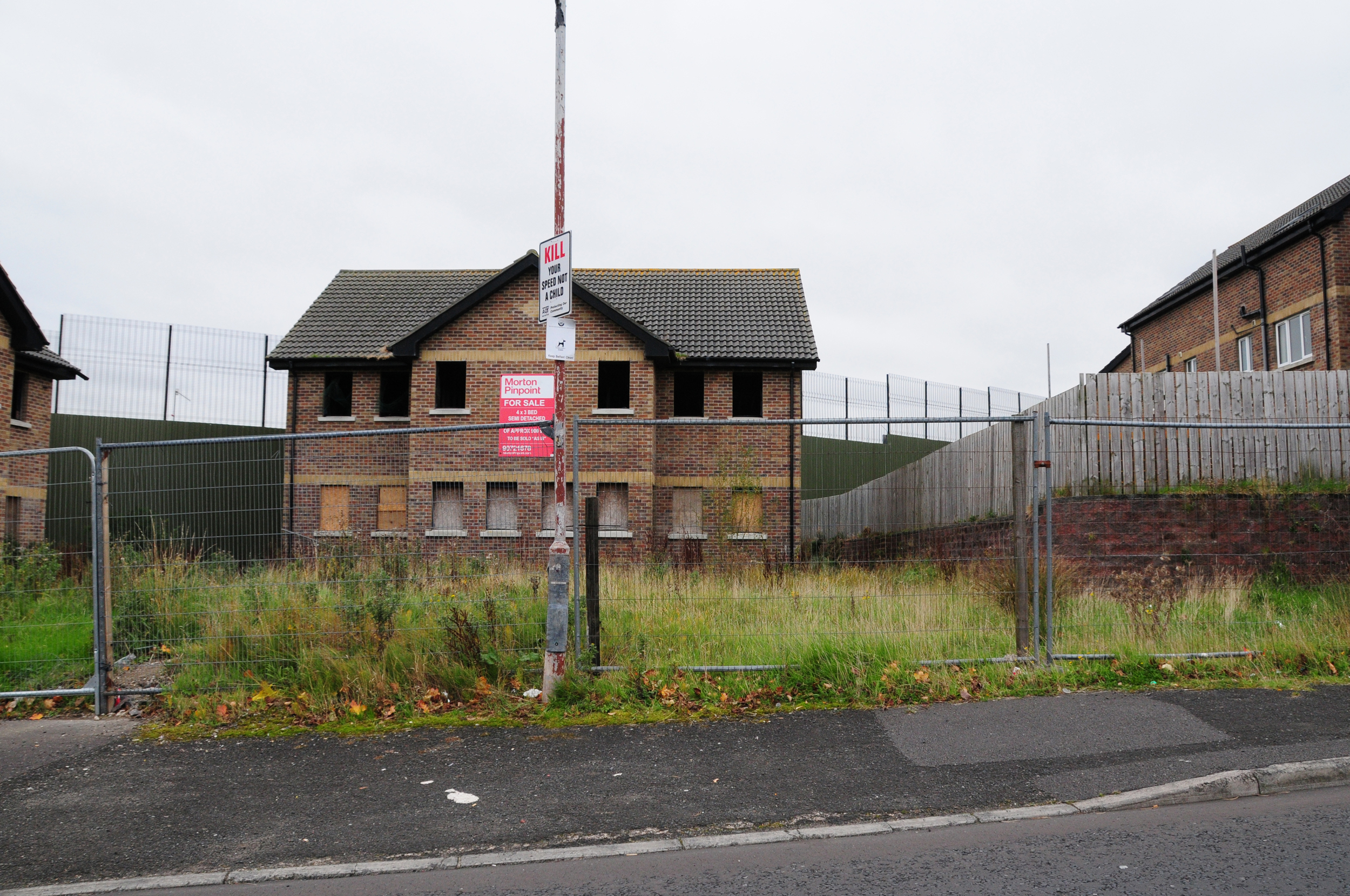
Kells Avenue
3.1.1 Reference code(s)
UK INT-ARC PA2015 CL01-P0001
3.1.2 Title
Photograph of Interface Barrier at edge of Malinmore Park rom Kells Avenue.
3.1.3 Cluster
BIP Interface Cluster 01: Suffolk / Lenadoon
3.1.4 Owner
NI Department of Justice
3.1.5 Year built:
1970s & 1996
3.1.6 Type
A 3.8 metre high double palisade fence runs for 200 metres at the edge of the park. It is covered in places with metal sheeting to limit visual contact.
3.2.1 Date of description
2015
3.2.2 Level of description
Items
3.2.3 Extent and Medium
Digital Image - 4288 × 2848 NIKON D300 Colour
3.2.4 Name of creator(s)
© James O'Leary
3.2.5 Archival History
Archived on December 10, 2015
3.4.1 Conditions of access
No restrictions on access. Reproduction requires permission.
Workman Avenue
3.1.1 Reference code(s)
UK INT-ARC PA2015 CL03-P0006
3.1.2 Title
Photograph of Interface Barrier Gate at Workman Avenue from east side.
3.1.3 Cluster
BIP Interface Cluster 03: Falls / Shankill
3.1.4 Owner
NI Department of Justice
3.1.5 Year built:
1990
3.1.6 Type
A 3.6 metres high metal gate, topped with open metal mesh fencing with a pedestrian entrance that controls access to Workman Avenue from Springfield Road
3.2.1 Date of description
2014
3.2.2 Level of description
Items
3.2.3 Extent and Medium
Digital Image - 4288 × 2848 NIKON D300 Colour
3.2.4 Name of creator(s)
© James O'Leary
3.2.5 Archival History
Archived on June 5, 2015
3.4.1 Conditions of access
No restrictions on access. Reproduction requires permission.
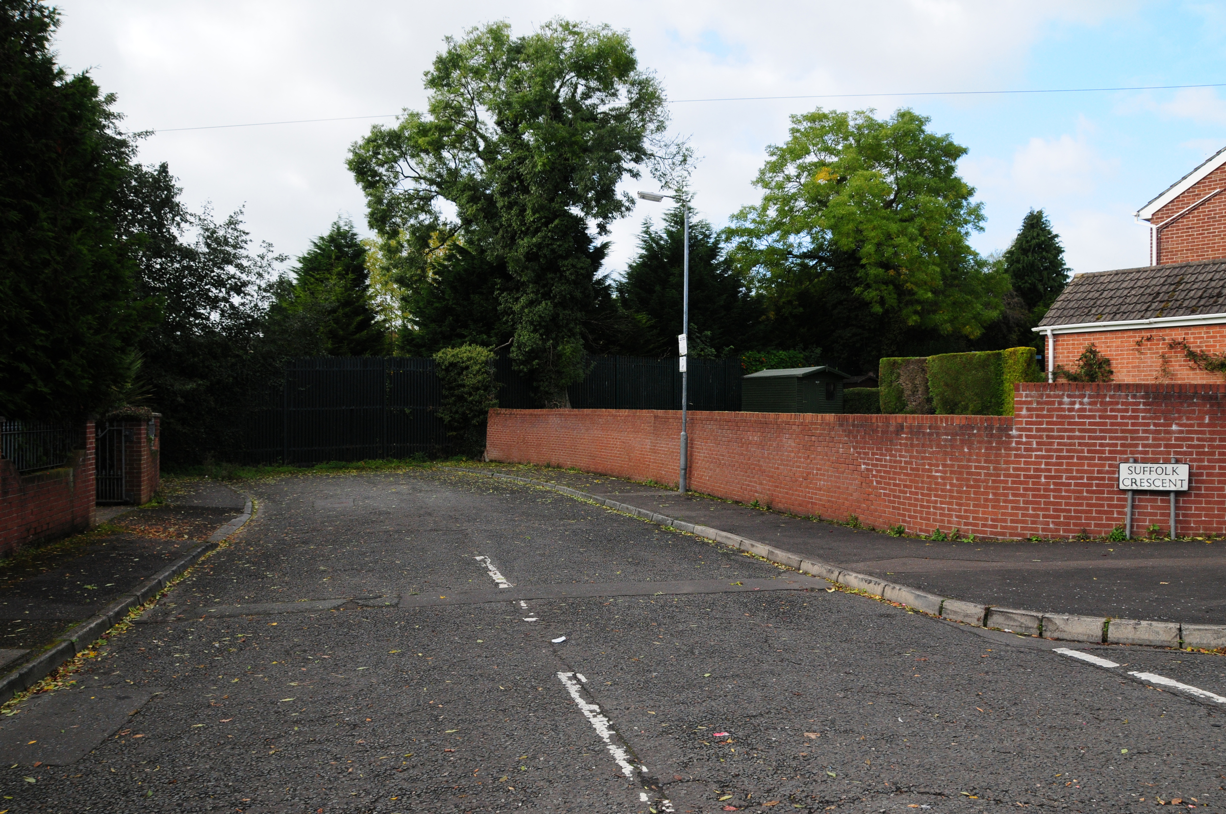
Suffolk Crescent
3.1.1 Reference code(s)
UK INT-ARC PA2015 CL01-P0002
3.1.2 Title
Photograph of Interface Barrier at edge of Malinmore Park closing access to Suffolk Crescent.
3.1.3 Cluster
BIP Interface Cluster 01: Suffolk / Lenadoon
3.1.4 Owner
NI Department of Justice
3.1.5 Year built:
1970s & 1996
3.1.6 Type
A 3.8 metre high double palisade fence runs for 200 metres at the edge of the park. It is covered in places with metal sheeting to limit visual contact.
3.2.1 Date of description
2015
3.2.2 Level of description
Items
3.2.3 Extent and Medium
Digital Image - 4288 × 2848 NIKON D300 Colour
3.2.4 Name of creator(s)
© James O'Leary
3.2.5 Archival History
Archived on December 10, 2015
3.4.1 Conditions of access
No restrictions on access. Reproduction requires permission.
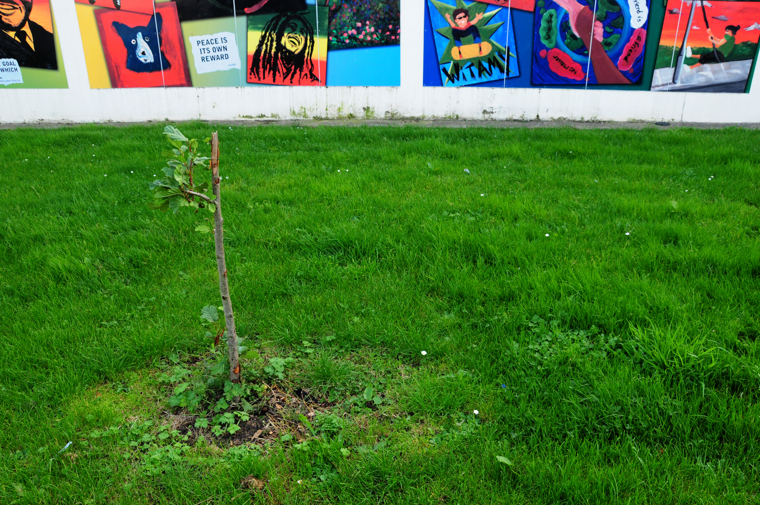
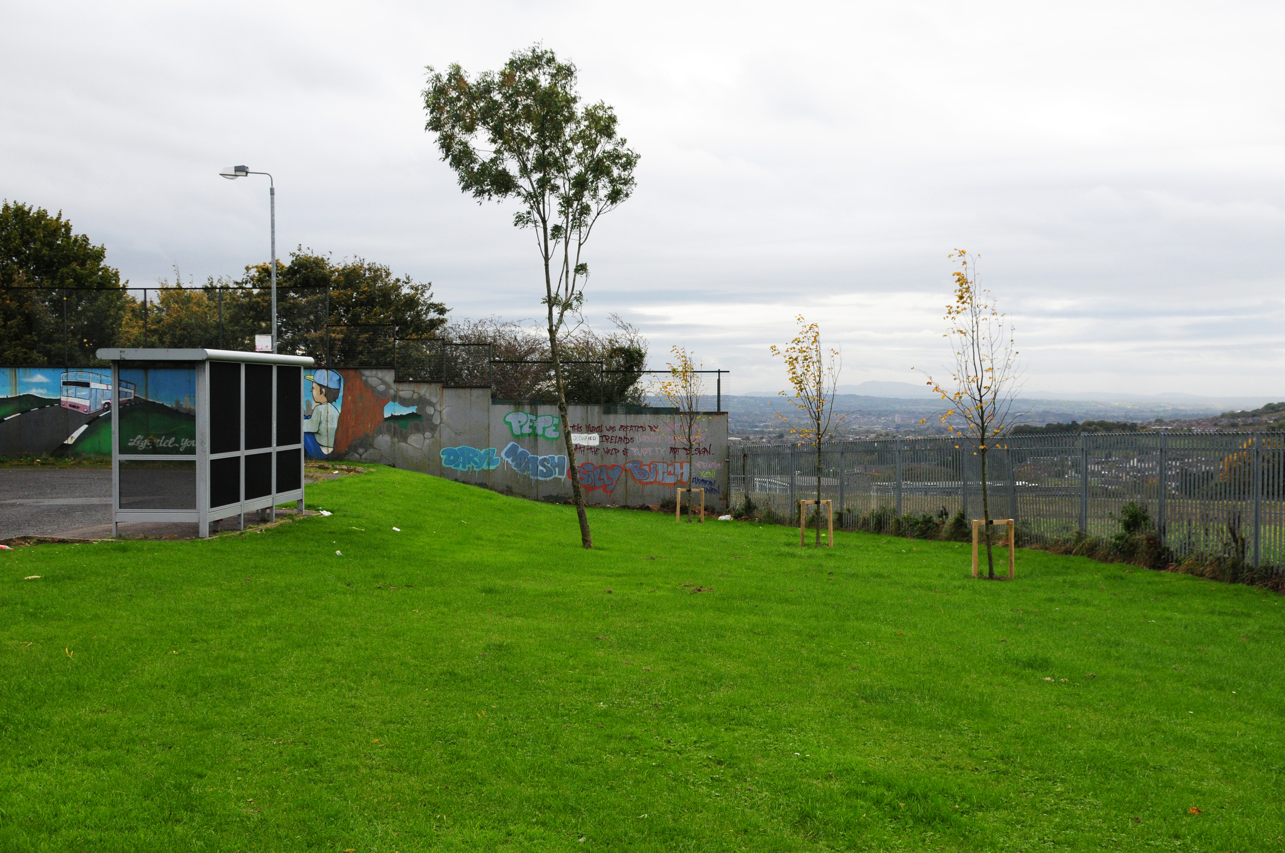
Woodbourne Crescent
3.1.1 Reference code(s)
UK INT-ARC PA2015 CL01-P0003
3.1.2 Title
Photograph of landscaping at interface buffer zone adjacent to Woodbourne Crescent.
3.1.3 Cluster
BIP Interface Cluster 01: Suffolk / Lenadoon
3.1.4 Owner
NI Department of Justice
3.1.5 Year built:
1970s & 1996
3.1.6 Type
An interstitial buffer zone bounded by 3m high palisade fencing and a PSNI station.
3.2.1 Date of description
2015
3.2.2 Level of description
Items
3.2.3 Extent and Medium
Digital Image - 4288 × 2848 NIKON D300 Colour
3.2.4 Name of creator(s)
© James O'Leary
3.2.5 Archival History
Archived on December 10, 2015
3.4.1 Conditions of access
No restrictions on access. Reproduction requires permission.
Horn Drive
3.1.1 Reference code(s)
UK INT-ARC PA2015 CL01-P0004
3.1.2 Title
Photograph of landscaping at interface buffer zone adjacent to Horn Drive.
3.1.3 Cluster
BIP Interface Cluster 01: Suffolk / Lenadoon
3.1.4 Owner
NI Housing Executive
3.1.5 Year built:
2000s
3.1.6 Type
An interstitial buffer zone bounded by 2.5m high palisade fencing and Woodburn PSNI station, with gated access that controls access at certain times.
3.2.1 Date of description
2015
3.2.2 Level of description
Items
3.2.3 Extent and Medium
Digital Image - 4288 × 2848 NIKON D300 Colour
3.2.4 Name of creator(s)
© James O'Leary
3.2.5 Archival History
Archived on December 10, 2015
3.4.1 Conditions of access
No restrictions on access. Reproduction requires permission.
Stewartstown Road
3.1.1 Reference code(s)
UK INT-ARC PA2015 CL01-P0006
3.1.2 Title
Photograph of interface buffer zone adjacent to Stewardstown Road, currently used as a car wash.
3.1.3 Cluster
BIP Interface Cluster 01: Suffolk / Lenadoon
3.1.4 Owner
Unknown
3.1.5 Year built:
Unknown
3.1.6 Type
An interstitial buffer zone bounded by 3m high palisade fencing, with plastic sheeting woven into the fencing to limit visual access. Woodburn PSNI station bounds the area on the northern edge.
3.2.1 Date of description
2015
3.2.2 Level of description
Items
3.2.3 Extent and Medium
Digital Image - 4288 × 2848 NIKON D300 Colour
3.2.4 Name of creator(s)
© James O'Leary
3.2.5 Archival History
Archived on December 10, 2015
3.4.1 Conditions of access
No restrictions on access. Reproduction requires permission.
Wolfend Drive
3.1.1 Reference code(s)
UK INT-ARC PA2015 CL10-P0001
3.1.2 Title
Photograph of interface barrier separating Wolfend Drive from Squires Hill.
3.1.3 Cluster
BIP Interface Cluster 10: Ligoniel
3.1.4 Owner
NI Department of Justice
3.1.5 Year built:
1993 & 2003
3.1.6 Type
A solid metal fence with mesh fencing above, 82 metres long and 4 metres high
3.2.1 Date of description
2015
3.2.2 Level of description
Items
3.2.3 Extent and Medium
Digital Image - 4288 × 2848 NIKON D300 Colour
3.2.4 Name of creator(s)
© James O'Leary
3.2.5 Archival History
Archived on December 10, 2015
3.4.1 Conditions of access
No restrictions on access. Reproduction requires permission.
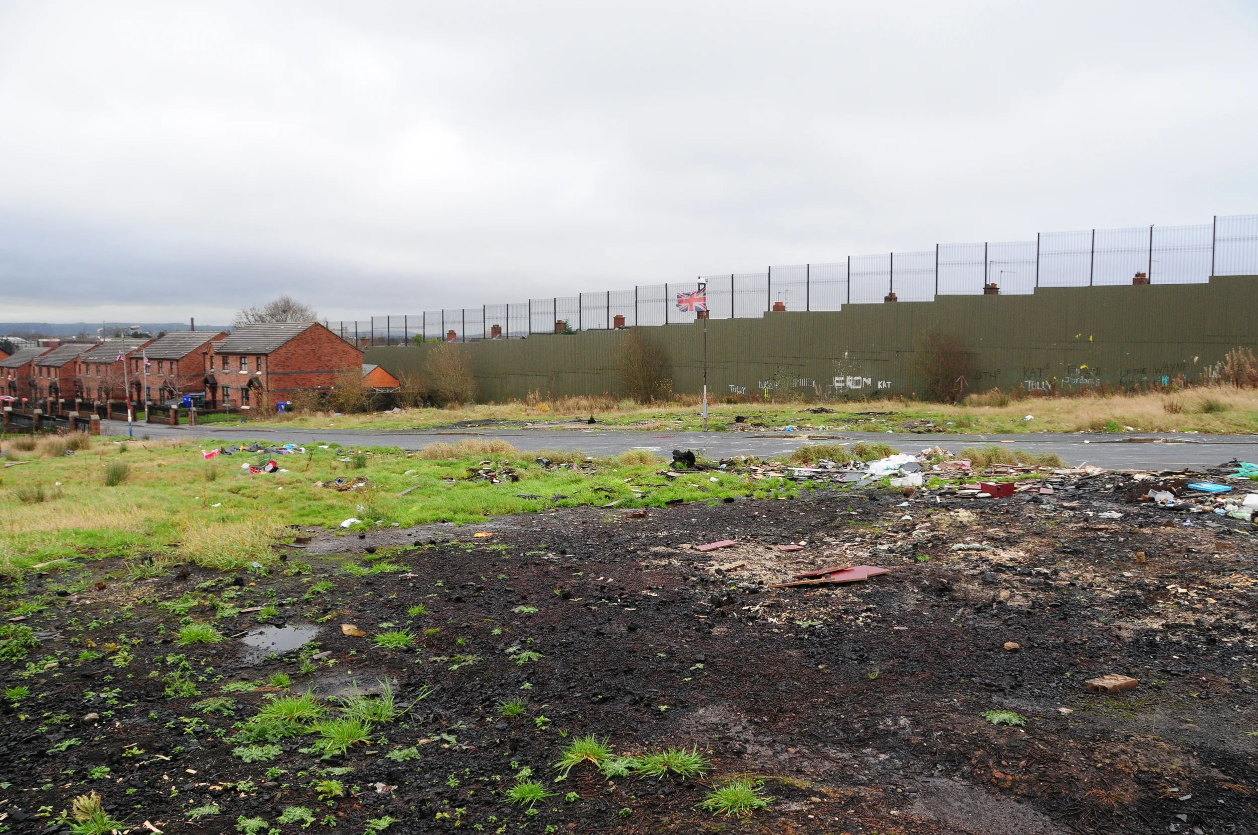
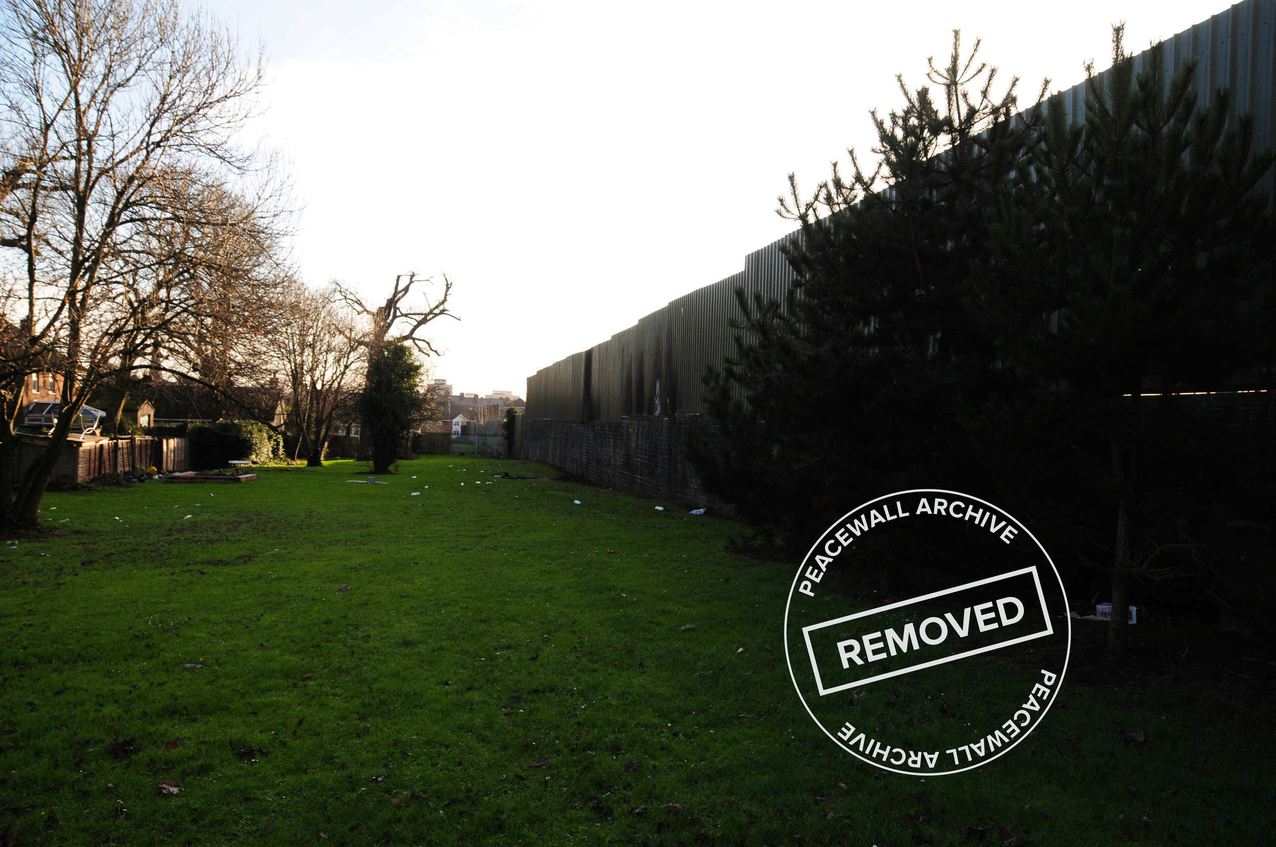
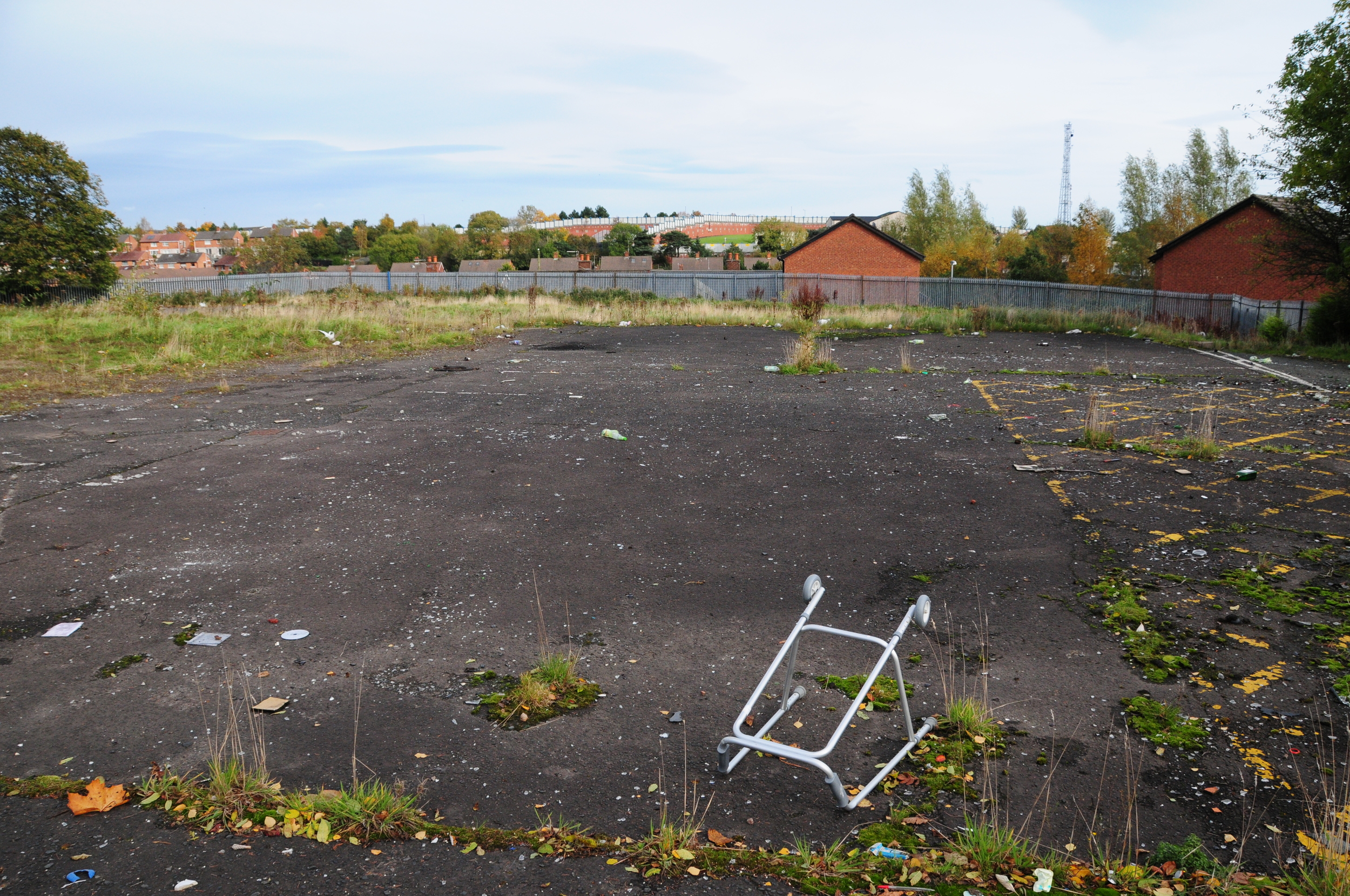
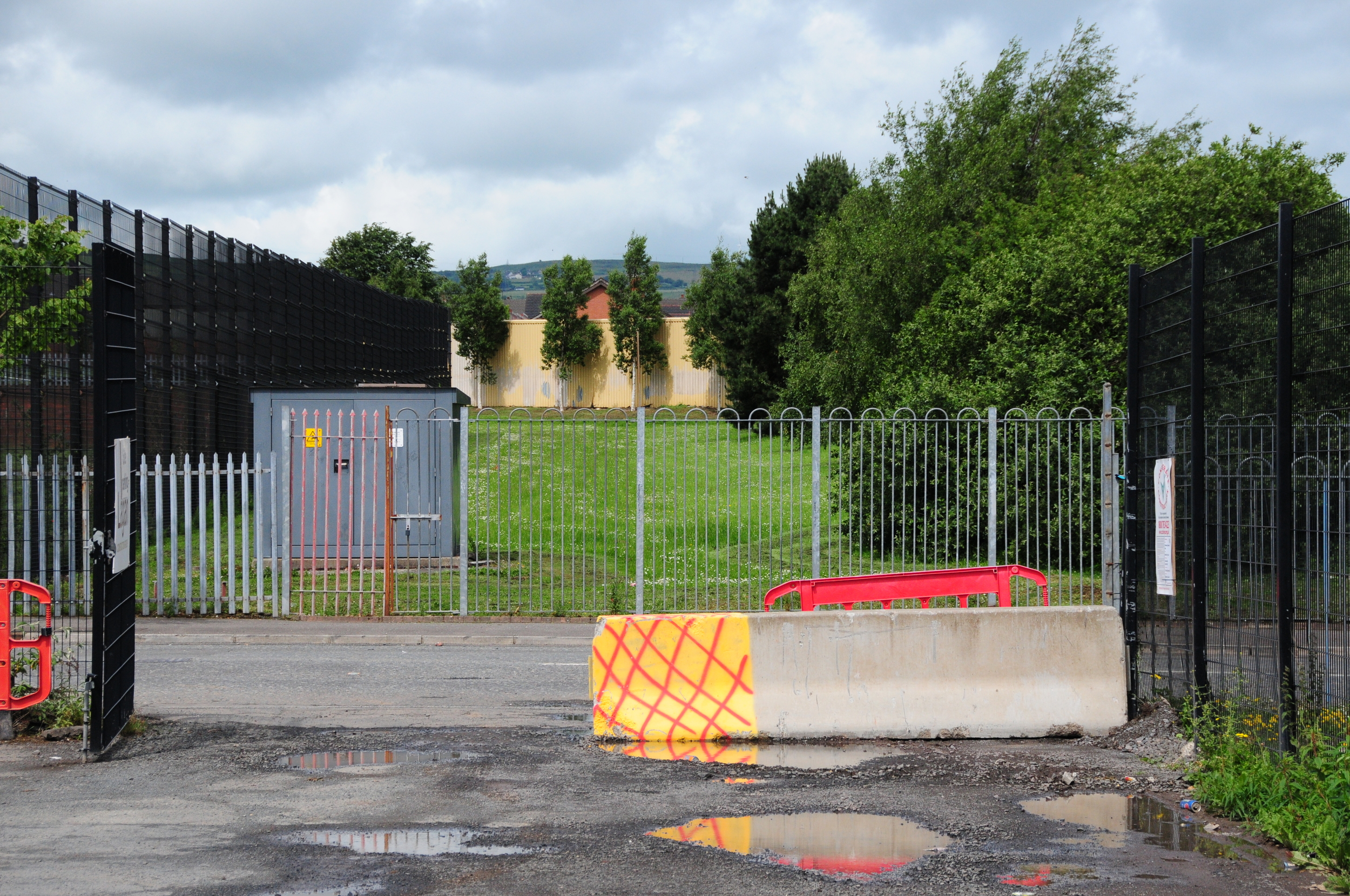
Glenbryn Park
3.1.1 Reference code(s)
UK INT-ARC PA2015 CL09-P0005
3.1.2 Title
Photograph of unfinished housing for sale at Glenbryn Park looking south toward the Interface barrier at Alliance Avenue.
3.1.3 Cluster
BIP Interface Cluster 09: Ardoyne-Glenbryn
3.1.4 Owner
NI Department of Justice
3.1.5 Year built:
1991 & 2003
3.1.6 Type
A steel and sheet metal barrier, up to 9 metres high.
3.2.1 Date of description
2015
3.2.2 Level of description
Items
3.2.3 Extent and Medium
Digital Image - 4288 × 2848 NIKON D300 Colour
3.2.4 Name of creator(s)
© James O'Leary
3.2.5 Archival History
Archived on December 10, 2015
3.4.1 Conditions of access
No restrictions on access. Reproduction requires permission.
Flax Street
3.1.1 Reference code(s)
UK INT-ARC PA2015 CL09-P0006
3.1.2 Title
Photograph of interface barrier on Flax Street looking south toward the former Dunnes Stores site.
3.1.3 Cluster
BIP Interface Cluster 09: Ardoyne-Glenbryn
3.1.4 Owner
NI Department of Justice
3.1.5 Year built:
1994
3.1.6 Type
A 2.5 metre high block wall topped with a steel anti-climb device.
3.2.1 Date of description
2015
3.2.2 Level of description
Items
3.2.3 Extent and Medium
Digital Image - 4288 × 2848 NIKON D300 Colour
3.2.4 Name of creator(s)
© James O'Leary
3.2.5 Archival History
Archived on December 10, 2015
3.4.1 Conditions of access
No restrictions on access. Reproduction requires permission.
Springfield Road
3.1.1 Reference code(s)
UK INT-ARC PA2015 CL03-P0009
3.1.2 Title
Photograph of Interface Barrier along the Lower Springfield Road.
3.1.3 Cluster
BIP Interface Cluster 03: Falls / Shankill
3.1.4 Owner
NI Department of Justice
3.1.5 Year built:
1988 & 2003
3.1.6 Type
A 3 metre high brick wall, topped with an 4 metre high undulating open metal mesh fencing.
3.2.1 Date of description
2015
3.2.2 Level of description
Items
3.2.3 Extent and Medium
Digital Image - 4288 × 2848 NIKON D300 Colour
3.2.4 Name of creator(s)
© James O'Leary
3.2.5 Archival History
Archived on December 11, 2015
3.4.1 Conditions of access
No restrictions on access. Reproduction requires permission.
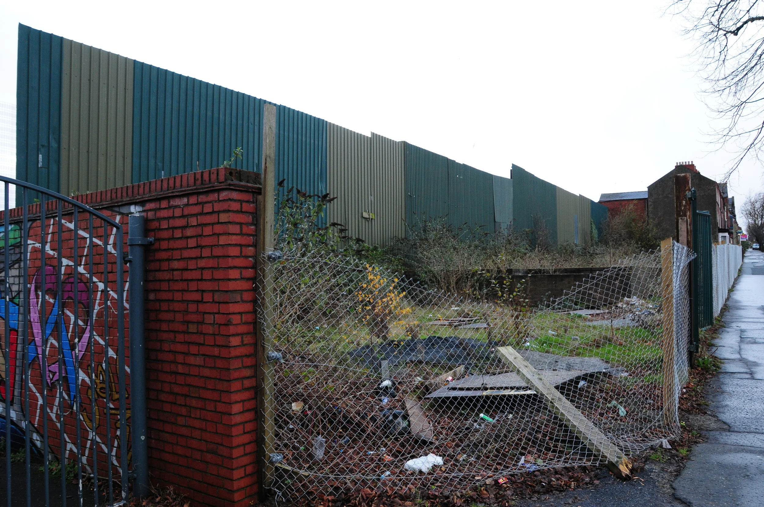
Cliftonpark Avenue
3.1.1 Reference code(s)
UK INT-ARC PA2015 CL08-P0009
3.1.2 Title
Photograph of various Interface Barriers at Cliftonpark Avenue looking northwest toward buffer zone adjacent to Rosevale Street Interface Barrier.
3.1.3 Cluster
BIP Interface Cluster 08: Lower Oldpark / Manor Street
3.1.4 Owner
NI Department of Justice
3.1.5 Year built:
1980s
3.1.6 Type
A combination of 2 metre and 3 meter high palisade fencing, concrete barriers, buffer zone, and a metal barrier 200 metres long and 4 metres high.
3.2.1 Date of description
2015
3.2.2 Level of description
Items
3.2.3 Extent and Medium
Digital Image - 4288 × 2848 NIKON D300 Colour
3.2.4 Name of creator(s)
© James O'Leary
3.2.5 Archival History
Archived on December 11, 2015
3.4.1 Conditions of access
No restrictions on access. Reproduction requires permission.
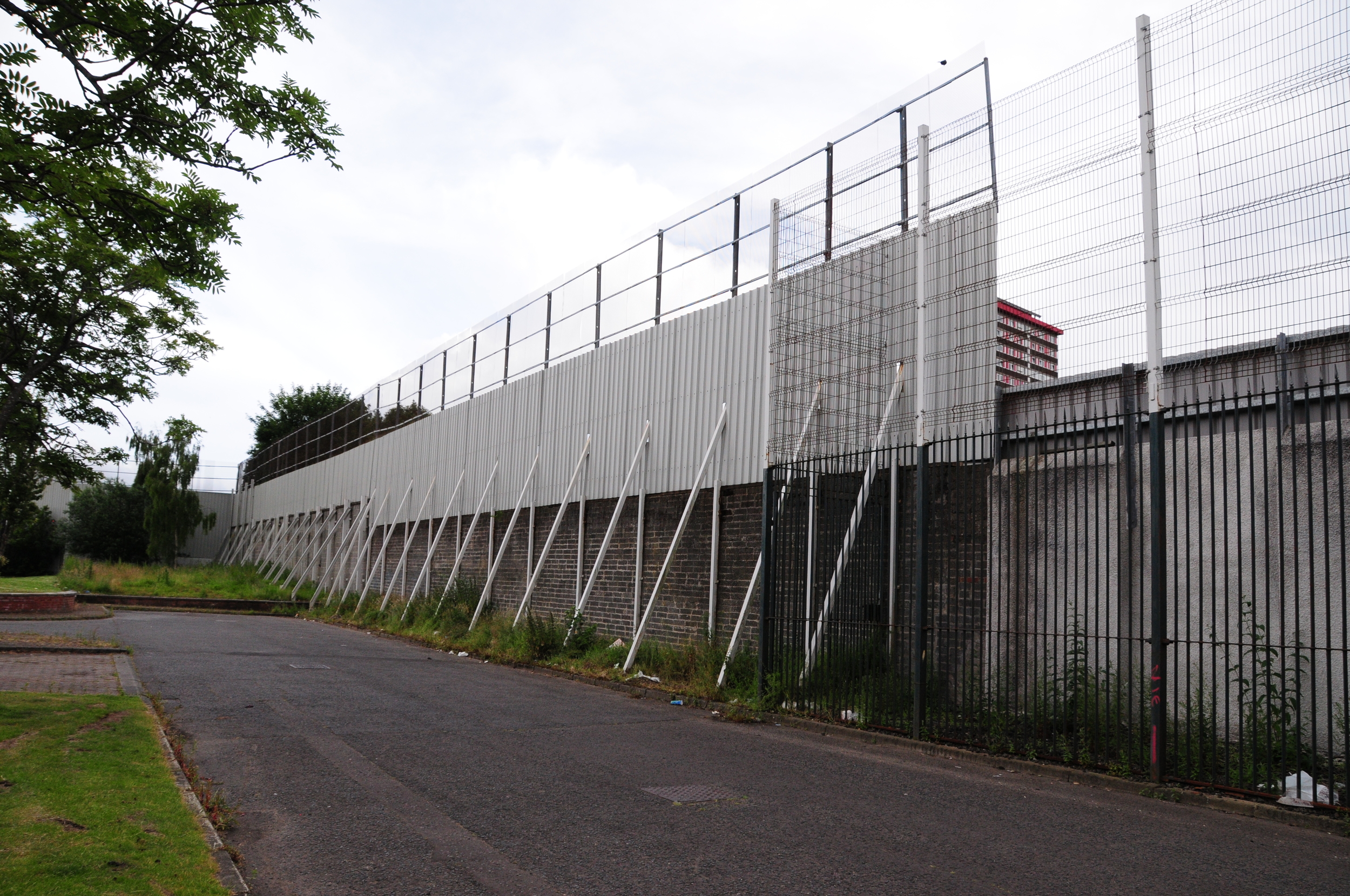
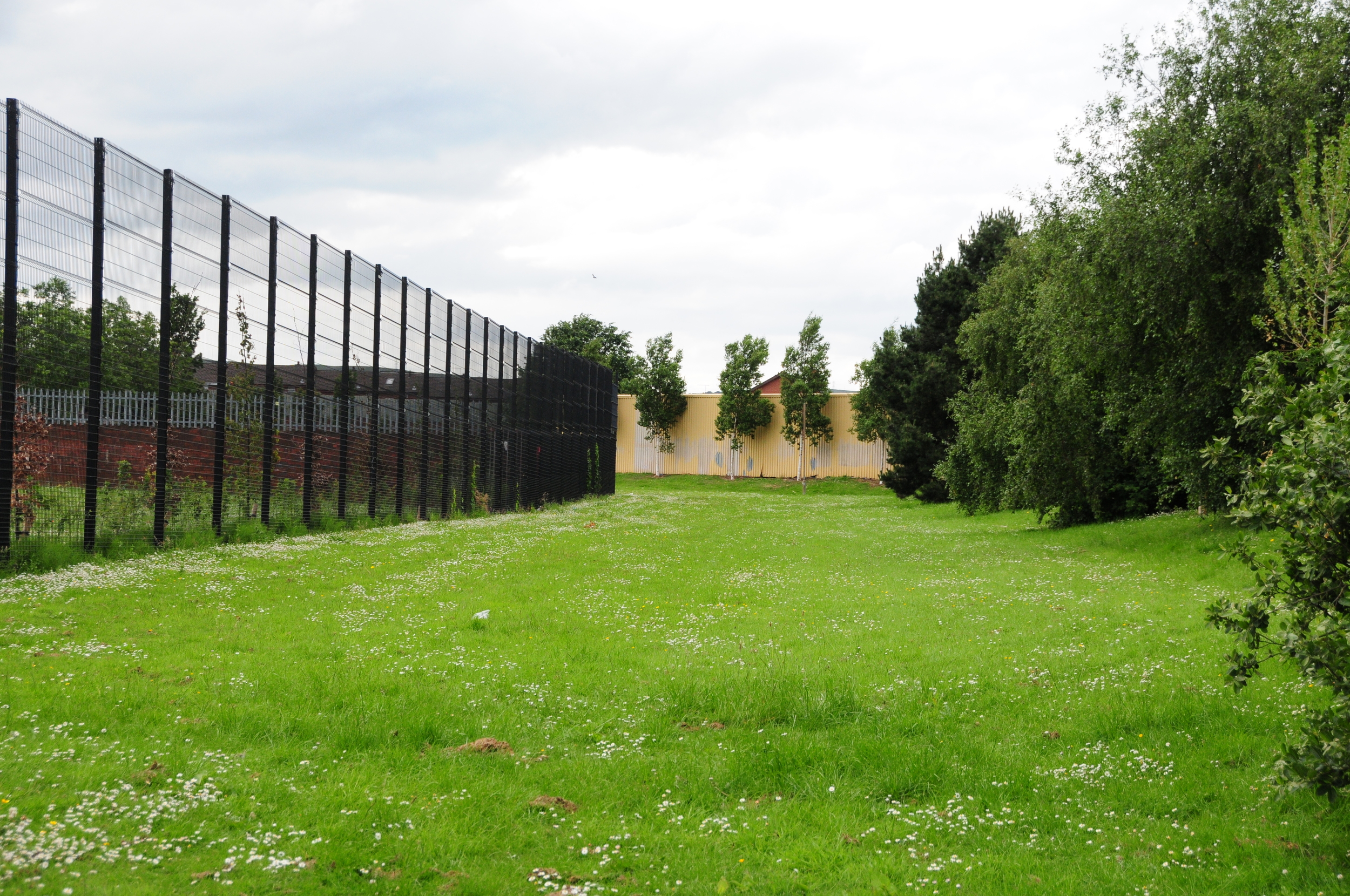
Cliftonpark Avenue
3.1.1 Reference code(s)
UK INT-ARC PA2015 CL08-P0011
3.1.2 Title
Photograph of newly-constructed Interface Barriers at Cliftonpark Avenue looking northwest from Brucevale Park.
3.1.3 Cluster
BIP Interface Cluster 08: Lower Oldpark / Manor Street
3.1.4 Owner
Unknown
3.1.5 Year built:
2015
3.1.6 Type
2.5 meter high sheet metal fencing, with still stanchions and concrete block reinforcement. This interface was constructed as a requirement prior to the demolition of the Girdwood perimeter interface.
3.2.1 Date of description
2015
3.2.2 Level of description
Items
3.2.3 Extent and Medium
Digital Image - 4288 × 2848 NIKON D300 Colour
3.2.4 Name of creator(s)
© James O'Leary
3.2.5 Archival History
Archived on December 11, 2015
3.4.1 Conditions of access
No restrictions on access. Reproduction requires permission.
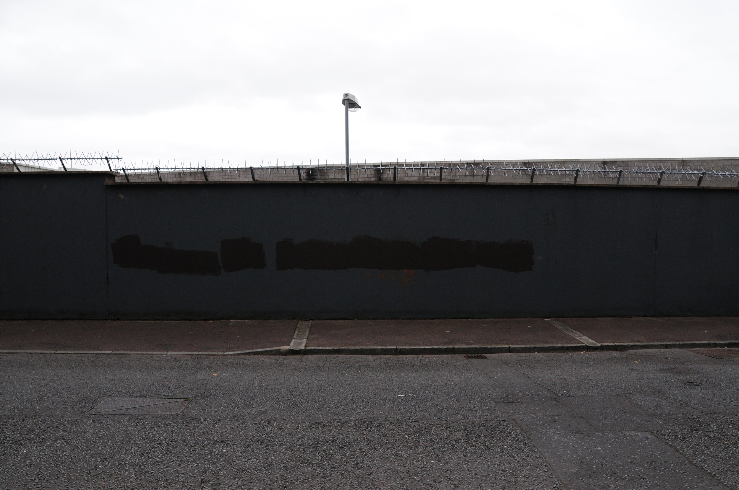
Rosevale Street
3.1.1 Reference code(s)
UK INT-ARC PA2015 CL08-P0010
3.1.2 Title
Photograph of buffer zone between Cliftonpark and Rosevale Street Interface Barrier.
3.1.3 Cluster
BIP Interface Cluster 08: Lower Oldpark / Manor Street
3.1.4 Owner
NI Department of Justice
3.1.5 Year built:
1980s
3.1.6 Type
3 meter high palisade fencing, buffer zone, and a sheet metal barrier 200 metres long and 4 metres high.
3.2.1 Date of description
2015
3.2.2 Level of description
Items
3.2.3 Extent and Medium
Digital Image - 4288 × 2848 NIKON D300 Colour
3.2.4 Name of creator(s)
© James O'Leary
3.2.5 Archival History
Archived on December 11, 2015
3.4.1 Conditions of access
No restrictions on access. Reproduction requires permission.
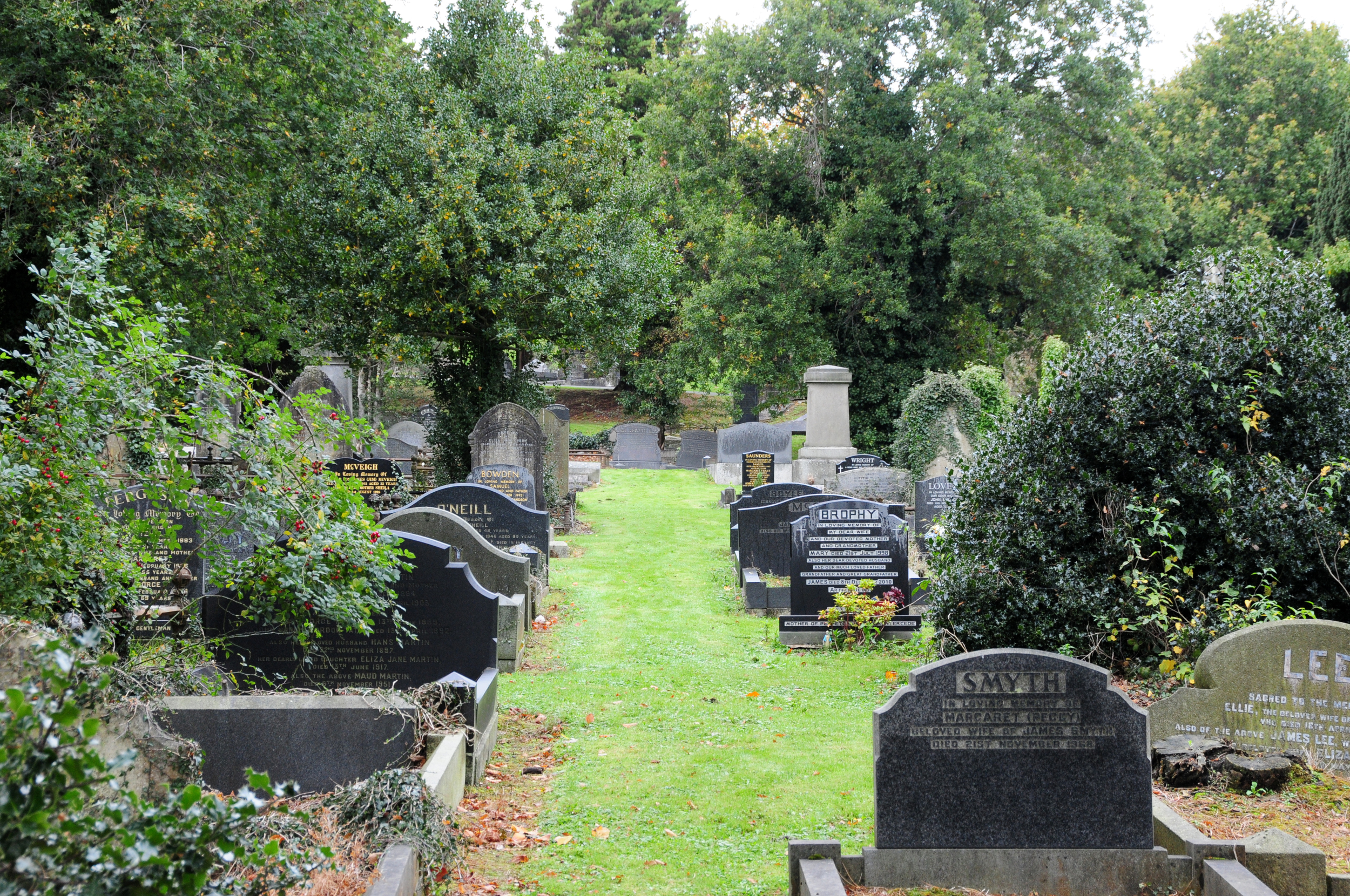
Belfast's Oldest Interface
3.1.1 Reference code(s)
UK INT-ARC PA2015 CL04-P0001
3.1.2 Title
Photograph of line of underground Interface Barrier in the Belfast City Cemetery
3.1.3 Cluster
BIP Interface Cluster 04: The Village / Westlink
3.1.4 Owner
Belfast City Council
3.1.5 Year built:
1866
3.1.6 Type
Underground wall 9 feet deep separating Catholic and Protestant grave sites.
3.2.1 Date of description
2015
3.2.2 Level of description
Items
3.2.3 Extent and Medium
Digital Image - 4288 × 2848 NIKON D300 Colour
3.2.4 Name of creator(s)
© James O'Leary
3.2.5 Archival History
Archived on December 11, 2015
3.4.1 Conditions of access
No restrictions on access. Reproduction requires permission.
Kinnaird Close
3.1.1 Reference code(s)
UK INT-ARC PA2015 CL08-P0001
3.1.2 Title
Photograph of Interface Barrier at corner of Kinnaird Close and Brucevale Park from east side
3.1.3 Cluster
BIP Interface Cluster 08: Lower Oldpark / Manor Street
3.1.4 Owner
NI Department for Social Development
3.1.5 Year built:
1978
3.1.6 Type
A steel and sheet metal barrier, topped with open mesh in places, up to 5 metres high.
3.2.1 Date of description
2014
3.2.2 Level of description
Items
3.2.3 Extent and Medium
Digital Image - 4288 × 2848 NIKON D300 Colour
3.2.4 Name of creator(s)
© James O'Leary
3.2.5 Archival History
Archived on June 5, 2015
3.4.1 Conditions of access
No restrictions on access. Reproduction requires permission.
Interfaces
Image collection of Belfast Interface Barriers, all photographed in 2014-2015